
(1940-July 1, 2003)
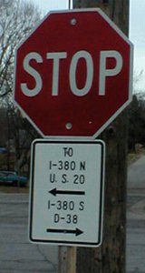
NORTH End: Stop sign, D22/Old US 20, Raymond, Black Hawk County
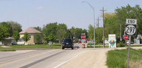
Facing north on 297 (5/20/03)
Highway 297 is a spur that for most of its life came south from US 20, but after completion of the freeway went from one county road to another, intersecting 20 in between. Despite being around for a long time, it is actually the second incarnation of the number; looking through old 1930s maps I found a first version created to serve Alexander at the same time surrounding numbers were commissioned.
Facing north on 297 (6/3/14)
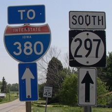
Large white-background panels like this were placed at intersections along old 20 when construction along I-380 in 2012 occasionally shut down the freeway.
Facing north on 297 (1/9/02, still there in 2014)
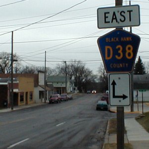
Facing east on 297 (6/3/14)
Just left of center in this picture is the bracket that held the signs below. The LGS is county-made.
Facing east on D22 (1/9/02)
Driving on D22, you can tell it was once a major thoroughfare. For instance, here we have a short portion of divided highway. D22 - old 20 - is also divided on the east side of Waterloo. The middle of the bracket held US 20 shields, as for a short time the freeway ended at the interchange to the south. The Waterloo Courier once spoke of being able to just see the glimmer of freeway on the outskirts of the city. (Or something like that. Waterloo was ecstatic to get its interstate.)
Facing west on D22 (5/20/03)
There is no signage for D22 beyond this intersection; it is just treated as a paved, unmarked road, with the trappings of a "used to be" route. It's possible that the pieces in Black Hawk County east and west of here were decommissioned at different times.
This is part of the second routing of US 20 in Black Hawk County; the first came in to Waterloo on what is now IA 281 and Independence Avenue. The original extent of 297 was into downtown Waterloo on Lafayette Road until the late 1950s, when a new US 20 was constructed from downtown Waterloo to Jesup, and the north end was moved here.
Facing west on D22 (6/3/14)
Facing south on 297 (5/20/03)
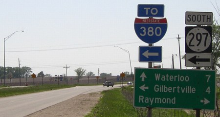
If you're in Black Hawk County, there's a "To I-380" sign near you, although quite a few have disappeared/been replaced with panels.
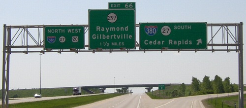
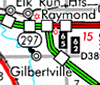
Surrounding area information: I-380 Exit 66
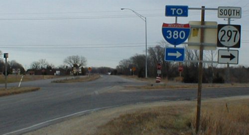
Facing north on 297 (1/9/02)
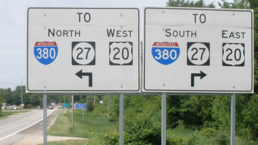
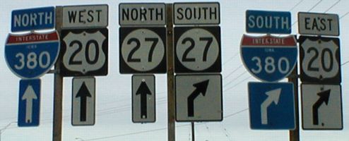
Since 1984, 297 has intersected 20 in about its middle. With the addition of the IA 27 signs, I thought that with the angles of the two side poles there was a nice symmetry going on (except the right 380 could be on the outside).
Facing west on 20 (5/20/03)
There is an additional BGS before the last one westbound; the ramp from 380 NB to the east-west freeway becomes an Exit Only ramp. This is the northernmost of four highways that intersected I-380 involved in the Second Great Decommissioning.
SOUTH End: Intersection, D38/14th Ave., Gilbertville, Black Hawk County
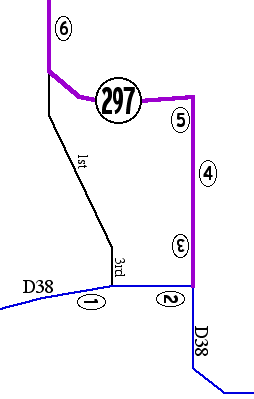
In Gilbertville, 297 changes course and heads east for a short time. In addition, there is some interesting signage going on. Working south to north (all photos 1/9/02):
Facing east on D38
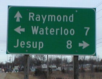
1) This sign is probably a relic from the pre-freeway days, given the distance to 20 (see LGS at bottom); I believe the back confirmed it. Eastbound traffic will find it shorter to use Third and First streets (see above) to reach 297 instead of going east.
Facing east on D22
2) Someone sure is being helpful. This is Fifth Street. Although there is no signing besides this, D38 turns south here for a bit but 297 goes north.
Facing south on 297 (probably)
3) Wait a second... East D38 goes in two directions at once? Strange. Notice the state/US highway-style directional auxiliary sign and the unconventional/strange arrow underneath. Also notice that the four lanes of Fifth Street go down to two.

Facing north on 297
4) The only indication of 297 on Fifth Street is this sign telling you it's going off Fifth Street. This is four blocks from the above picture.
Facing northeast
5) Notice the 297 signs on both ends of the picture; the left one is slightly hidden.
Facing north on 297
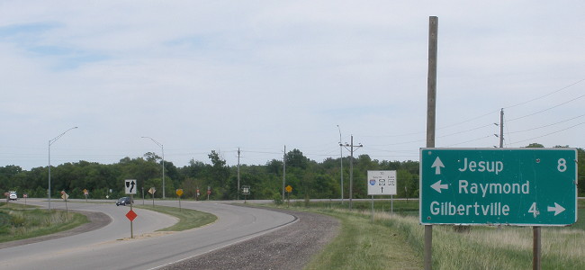
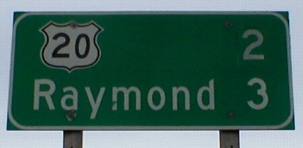
6) It's only a quarter of a mile after turning west that 297 goes north again. This LGS is at the city limits, about .7 mile north of the previous LGS. So how did the distance to 20 shrink to 2 miles that fast? Well, originally, it was 4 miles from the sign in #1 to 20. Here, it was 3 miles. You might be able to make out that the "2" is on green that is pasted over something. My guess is that the sign originally said 3 miles to both destinations. PS: The fonts for the 2 and 0 in the 20 shield don't match.
Last seen: 2003
All pictures by me: First, fourth, fifth, and seventh, 5/20/03; second, third, sixth, eighth-thirteenth, 1/9/02
Page created 3/9/02; last updated 1/17/15