According to official records, the creek crossing was turned over to
Polk County, not the city of Johnston. This is because
officially, Johnston's city limits here are only on the west
side of the road and the side doesn't start until about where that
stoplight is. Merle Hay Road is the west end of an area between about
Beaver Creek and Meredith Drive that neither Des Moines nor Johnston
wants to claim, containing the village of Lovington.
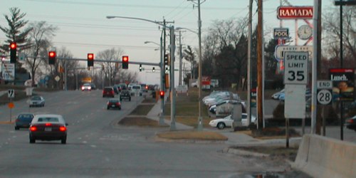
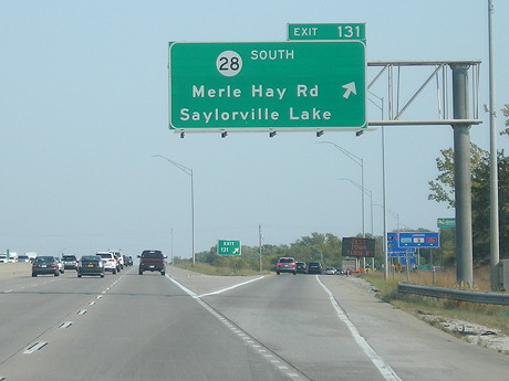
Facing north on 28, about the same spot (7/18/20)
In the upper right corner you can see the sign that in 2003 was for a
Ramada hotel and North End Diner. Those
closed in 2009 and were abandoned until demolition in 2017.
NORTH End: I-80/I-35 exit 131, Urbandale, Polk County
Facing north on 28 (center of road) (8/9/02)
Facing north on 28 (frontage road) (3/31/02)
Photo by Neil Bratney
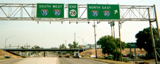
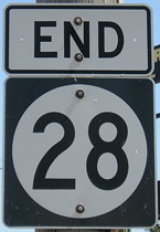
This is "End" sign #1, with somewhat oddly-shaped shields...
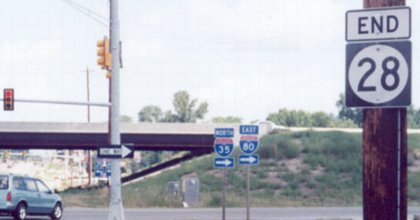
Facing north on 28 (July 2003 and 7/18/20)
Left photo by Jason Hancock
...and this is #2, which if you look closely was not in the August 2002
photo. Very likely, the "End 28" that was on the other side of the
bridge was moved here.
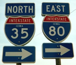
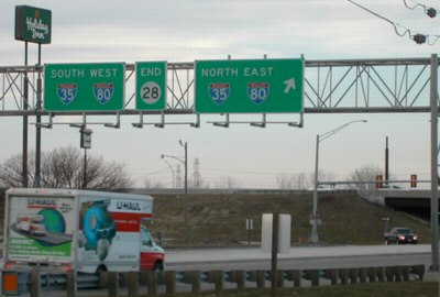
Facing north on 28 (8/9/02)
On the left are the quintessential Iowa interstate shields; the
"shadows" are identical shields facing the other direction. On the right
is the next set heading north, except this set's 35 doesn't have the
state name, a rarity for two-digit standalone shields. (However, the
newer 86th Street interchange has them all over the place.)
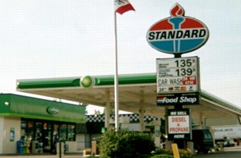
This Standard stood at the southeast corner of the intersection, near
the Quality Inn. Within five months after this picture was taken, August
2002-January 2003, it had been replaced with the "buzzsaw" BP, like on
the roof over the pumps. (8/9/02)

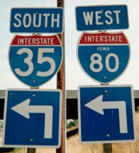
Facing west on 80, but heading south on 35 (12/24/01)
Facing west on 80, but facing south on 35 (May 2003)
Photo by Jason Hancock
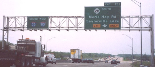
Two lanes can exit the interstate, the rightmost marked as "Exit Only".
The text is in a weird font (probably the funky font also used on US 18
around Mason City) and "Exit Only" in yellow blocks instead of the right
half of the sign (including the arrow) being in yellow. The interstate
shields are (or are nearly like) the pointier type seen on 28.
Facing east on 80, but heading north on 35 (10/31/07)
Facing east on 80, but heading north on 35 (10/9/20)
Old NORTH End (August 21, 1980-March 12, 1991): Stoplight/T
intersection, US 6/Hickman Road, Des Moines/Windsor Heights, Polk
County
Facing north on 28 (June 2002)
Photo by Jason Hancock
This was the north end of 28 before it was extended to take up IA 401's
route south of I-35/80.
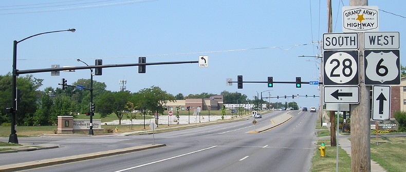
Facing north on 28 (8/13/18)
There's this new arm showing turn lanes, but no signs for either 28 or
6 here on northbound 63rd Street.
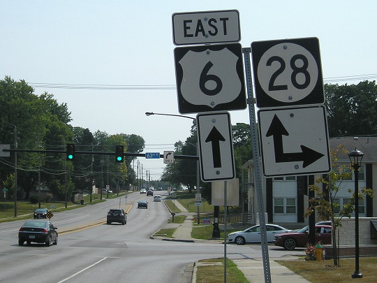
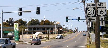
Facing east on 6 (8/13/18)
This intersection is the northeast corner of the small, enclosed suburb
Windsor Heights. The gas station that was here (below) is gone.
Facing west on 6 (8/21/04)
Facing west on 6 (8/13/18)
Old NORTH End (August 23, 1961-August 21, 1980): Stop sign,
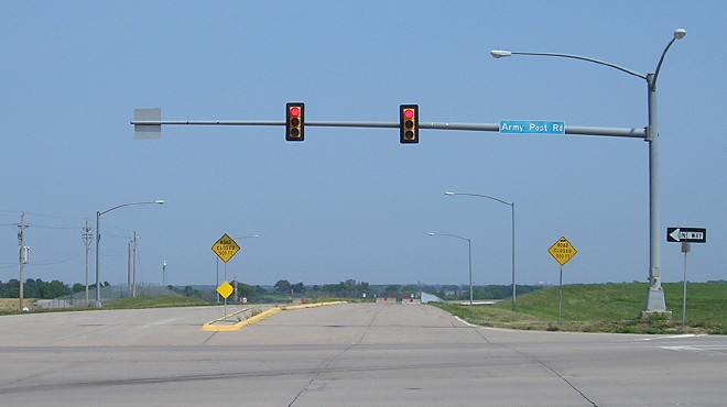
IA 5/Army Post Road, Des Moines, Polk County
Facing east on 5/Army Post Road (8/13/18)
The intersection of 42nd Street and Army Post Road — that is to say,
Old Army Post Road, renamed
Willow Creek Avenue in 2016 — bears the distinction of one of a
handful obliterated between their time as a highway endpoint and the
present. There are a few around where, if you managed to get to the
exact physical location of the old intersection, you'd still be able to
see where the modern equivalent is (for example, IA
210). Here, the roads to the east and south are gone, removed to
make way for a runway extension at the Des Moines airport.
Facing west on 5/Army Post Road (8/13/18)
If you look very closely, you can see the faint marks of where the
pavement began to divide to open a left-turn lane. Because the road
curves north to gravel now, the intersection would have been a smidge
behind the camera.
Facing north on 28/42nd Street (8/13/18)
This is the modern equivalent of the Army Post Road intersection, on
the other side of the new runway. Behind the camera is a short four-lane
stub that dead-ends at the IA 5 freeway and serves the Des Moines
Register's printing press.
Other north endpoints of IA 28 in Des Moines, based
on Jason Hancock's research, were Clifton Avenue (now a glorified
on-ramp to Thomas Beck Road) at Indianola Avenue/SW 7th Street (US 65 at
the time); 9th Street at Grand Avenue/IA 90 (after US 65-69 moved to
East 14th Street); and Army Post Road at Southeast 14th Street/US 65-69.
This means that over 65 years (1926-1991), 28 had six endpoints in or
near Des Moines. The south end, on the other hand, is a few hundred feet
around where it's been since the road west of Martensdale was paved
around 1931...
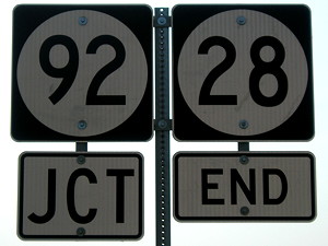
SOUTH End: Stop sign/T intersection, IA 92, Martensdale,
Warren County
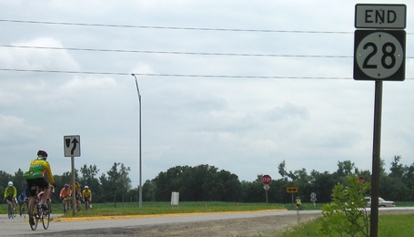
Facing south on 28 (7/21/09 and 10/9/20)
This is in the center of what was a triangle intersection that changed
in the 1970s; the northwest leg remains as a city street. The former
configuration allowed traffic going from southbound 28 to westbound 92,
or eastbound 92 to northbound 28, to flow freely without a railroad
crossing. It could have been an echo of the auto-trail era and the first
IA 15, which left now-US 169 at Winterset to head east and then north.
IA 28's historic endings in Des Moines (taking up the remainder of IA 15
that didn't later become US 69) made this the preferred Winterset-Des
Moines route until I-80 was built.
Facing south (10/9/20)
This photo is taken from the left-behind curve segment, now named South
Street. (It turned out this was the best way for this shot, since the
southwest-y view on an October afternoon looked straight into the sun.)
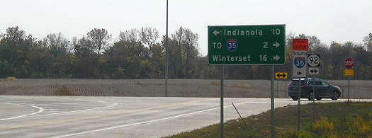
Facing northwest, but heading west, on 92 (10/9/20)
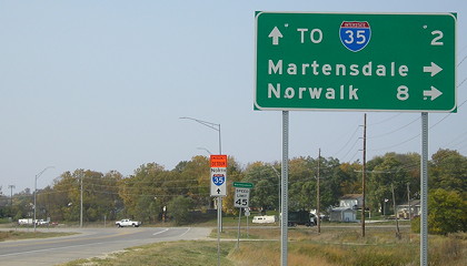
LGSs were added to this intersection when IA 92 was reconstructed here
in the 2010s.
Facing northwest, but heading west, on 92 (7/21/09)
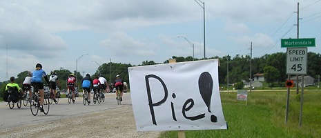
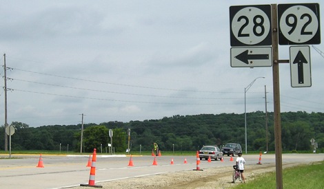
Really, when it comes to RAGBRAI, nothing more need be said.
Facing west on 92 (8/6/04)
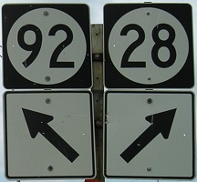
Closeup of shields at right (7/21/09)
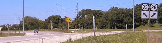
Facing west on 92 (10/9/20)
The mini-fork and diagonal-arrow shields aren't here anymore. Nor, for
that matter, are "92"s at the last sign set.
Facing east on 92 (10/9/20)
Facing east on 92 (7/21/09)
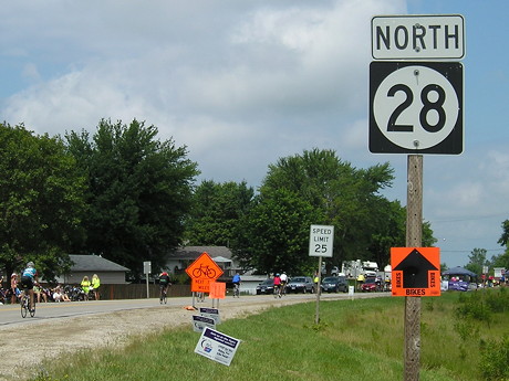
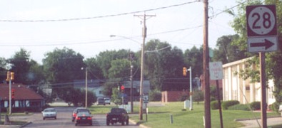
Facing north on 28 (first sign) (7/21/09)
Page created 2/12/02; last updated 1/20/08
1/12/21
Back to index