
(November 9, 1966-December 28, 1990)
For additional history of roads in this area, including a proposed but never-enacted plan to get rid of the highway running south from State Center, see these maps.
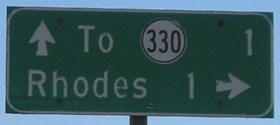
WEST End: Linn St., Rhodes, Marshall County
Facing west on 245 (Walnut at Main)
Measuring from the still-standing 1-mile marker, and according to the last route log for the full route, 245 would have taken a left turn here and ended on the block to the left.
Temporary EAST End (December 26, 1989-December 28, 1990): City limits of Rhodes, Marshall County
Facing west on 245
The DOT-standard sign is still up entering Rhodes 15 years after the portion of 245 inside the city limits was turned over. (See the map at the bottom of this page.) Signs were probably removed in the 1989 route swap, but Rhodes didn't take the road for a year.
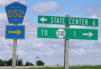
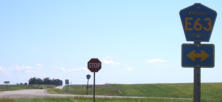
EAST End: Stop sign, IA 234 (now S52), Marshall County
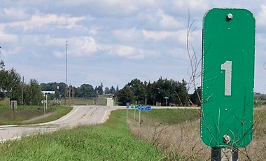
Facing east on 245
Facing east on 245
Today, the east-west traffic doesn't stop, but before these roads were paved IA 234 had the right of way.
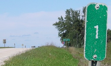
Facing north on 234
The 1-mile markers for both 234 and 245 are visible from the intersection.
Facing north on 234
Facing south on 234
This sign on a gravel road, visible in the above photo at left, is a leftover from 234's days as a state highway. It is probably the only DOT-standard mileage sign on a gravel road that isn't approaching an interchange. (Note that Marshall County has replaced the signs in the other directions.)
Facing south on 234
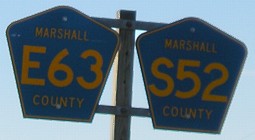
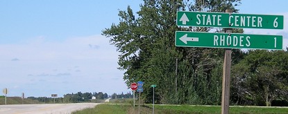
Facing west on 245
Here's a semi-rare occurrence: A marked duplex of county roads. They share virtually all of 245's length, except for the last three blocks in town where S52 goes north.
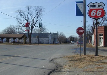
Is this heaven? No, it's ... Edenville?
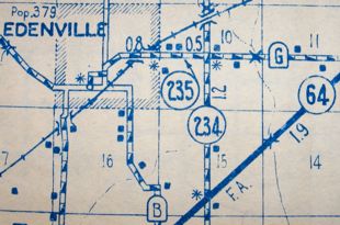
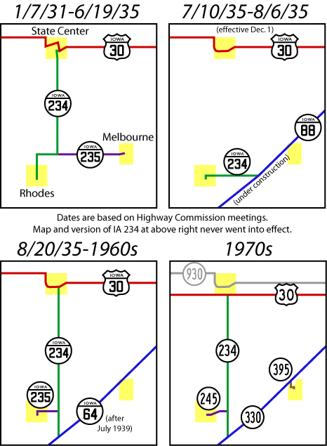
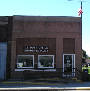
This 1941 map of Marshall County shows, instead of Rhodes, the town of Edenville. A 1930 Census listing at us-census.org notes "Edenville Town (Rhodes P.O.)" meaning Rhodes was the name of the post office but not the city. (Why they did such things back then I don't know.) On the other hand, a now-offline excerpt from a 1997 Central Iowa Genealogical Society newsletter article says this: "By 1853, Conway Rhodes, born in Ohio but recently of Illinois, secured large amount of land and on August 29, 1856, platted the town of Rhodes, which was then called Edenville, a name it held until 1928, and even then some residents refused to accept the change."
Sometime after this point, probably when the spur was paved, the route into Rhodes changed to curve southwestward from 234 into town and enter on the plain east-west street seen inside the city limits.
Last seen: 1989 and 1990 (1991 map)
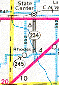
This is the last map 245 shows up on, but it appears it is caught halfway to decommissioning, which is exactly the case, although the map is a little slow. The 1988 route log is the last one that gives 245's full length, while the 1990 log is the last one showing the segment in town. The "245" pointing right into Rhodes, then, is technically correct for 1989 and 1990 but incorrect for the 1991 map.
Pictures by me: First, 12/14/02; second and fourth-tenth, 9/3/06; third, 11/23/06
Page created 1/21/02; last updated 3/17/17