
(December 23, 1947-July 1, 2003)
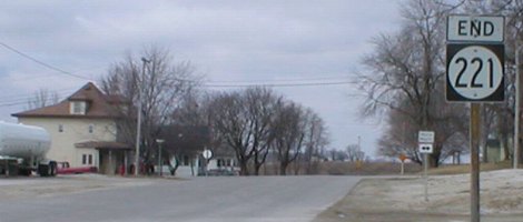
Old WEST End: Stop sign, US 69, Story County
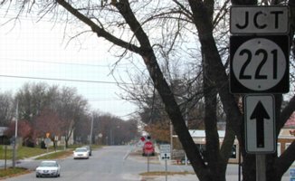
Facing west on 221 (6/24/17)
IA 221 was cut in half in 1980 because there wasn't much of a reason to keep the part between US 69 and I-35.
Facing west on 221 (6/24/17)
Facing south on 69 (6/24/17)
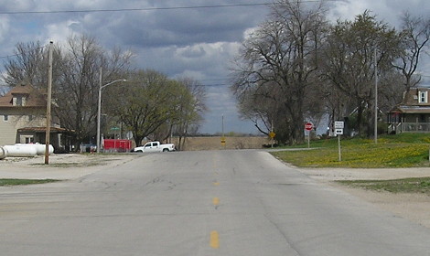
Facing southwest (6/24/17)
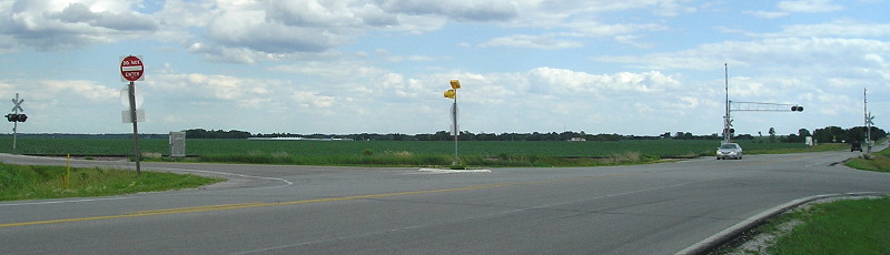
Look how close the railroad comes to the intersection, slicing through the road grid.
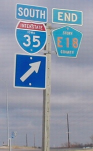
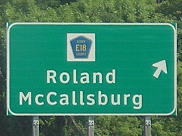
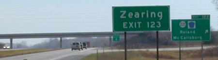
WEST End: I-35 exit 123, Story County
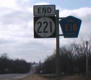
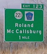
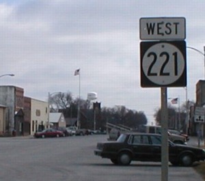
Facing west on 221 (3/15/02)
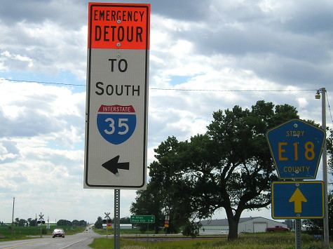
This sign is after the interchange; today only an E18 shield is here.
Facing east on E18 (3/15/02 and 9/5/03)
This sign was farther west than the end sign. Given its state, I'm pretty sure the March 2002 setup was from before 1980, when 221 was truncated at I-35 from US 69, 3 miles west of here. (There was no "Jct 221" sign, which is why I think it predates the end.)
Facing east on E18 (9/5/03 and 3/15/02)
East of the above sign, Story County did sign the end of E18. The second "East 221" sign can be seen at bottom left. The September 2003 picture of the LGS and sign behind it shows that the "End E18" has been removed. (The left picture was cropped from the picture that had the 35 signs above. It helps show the improvement in digital cameras since I started. I never got a chance for a better picture before...
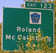
Facing west on E18 (7/6/11)
...the interchange signs were genericized.
Facing west on 221 (6/24/17)
The "End 221" sign was across the ramp, behind the left support for this sign.
Facing east on 221 (6/24/17)
Facing east on 221 (6/24/17)
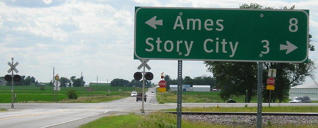
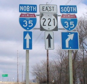
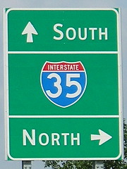
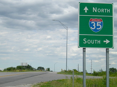
Facing north on 35 (3/15/02 and 9/5/03 and 3/15/02)
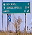
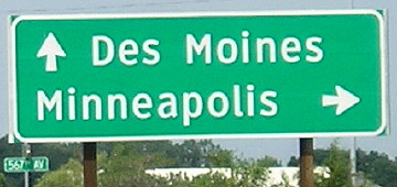
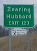
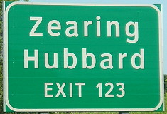
A candidate for the "How did THAT get on a sign?" award, Zearing (pop. 614) is 13 miles away; Hubbard is 23. Hubbard is listed for this exit because it was the "odd man out" for towns on IA 175, since only four can be listed at a time. On southbound 35, Hubbard is listed at Exit 139 (D41). (Although I wonder whether there is any signage anywhere after either exit.)
After the far right photo was taken, pranksters liberally applied spray paint to the sign in the background, changing "Hog Factories: Poisoning Iowa" to "Hog Factories: Feeding Iowa" with "Class of 2004" over the skull and crossbones.
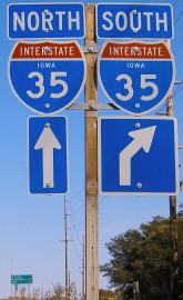
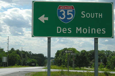
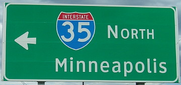
Facing north on 35 (September 2003)
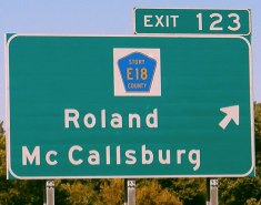
With the 221 shield pried off, the E18 shield is centered on this BGS, but not centered above the towns.
Facing north on 35 (7/6/11)
Facing north on 35 (7/6/11)
The last exit sign was missing its tab for some reason. Notice these are all Clearview.
Facing south on 35 (11/9/02)
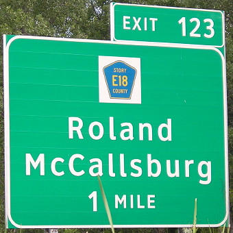
Because of the Story City exit, the preliminary BGS is half a mile away instead of a mile.
EAST End: Between Ash and Walnut streets, Roland, Story County
Facing west on E18 / Facing east on 221 (11/9/02 and 3/15/02)
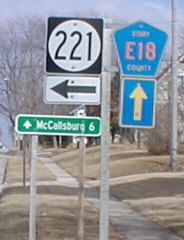
Highway 221 does NOT end at a four-way stop in Roland and continue as E18; instead it turns north and serves the business district on Main Street. However, westbound E18 only indicates 221 goes straight ahead. By the way, this intersection is a block east of R77.
Facing north, but heading east, on 221 (3/15/02)
A hypothesis of why 221 ends where it does has supporting evidence at 214: It went to the railroad tracks. Notice that the street stops entirely in a block and a half.
Facing north, but heading east, on 221, post-decommissioning (4/17/16)
Facing south, but heading west, on 221 (3/15/02)
A block and a half south of here 221 turns west for its journey to I-35. The pavement also widened a bit here (not shown).
Facing south, but heading west, on 221 (4/17/16)
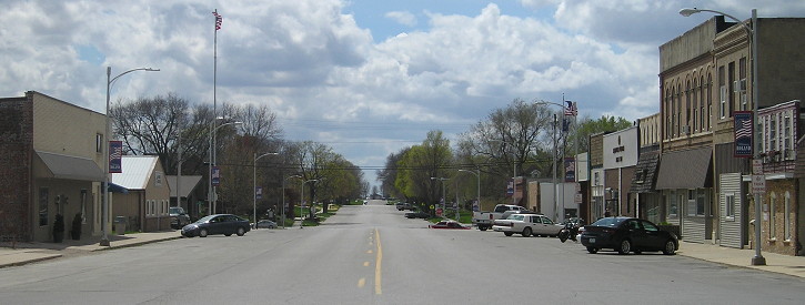
Here's a wider view of downtown. The four-way stop in the center is where 221 used to turn west.
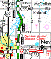
Last seen: 2003 (2003 map)
Page created 4/16/02; last updated 1/14/18