
| IA 21 (II) endpoint history | |||
| FROM | TO | NORTH | SOUTH |
| 1921 | 9/7/39 | IA 8 | US 6 (County Line Rd at 3rd St, Victor) |
| 9/7/39 | 8/11/69 | IA 92 | |
| 8/11/69 | 8/26/80 | IA 412 | IA 92 |
| 8/26/80 | 10/25/83 | IA 149 | |
| 10/25/83 | Present | US 20 | |
Old NORTH End: Stoplight/T intersection, Old IA 412/San Marnan Drive, Waterloo, Black Hawk County
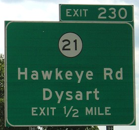
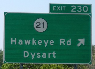
NORTH End: Interchange, US 20/IA 27, Waterloo, Black Hawk County
After some research, I have determined that DOT jurisdiction of IA 21 stops at the top of the interchange. First, let's go to the air:
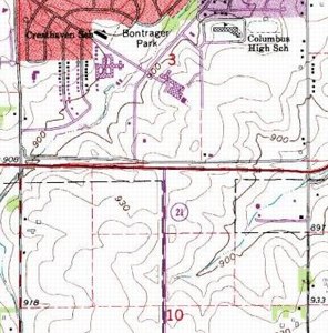
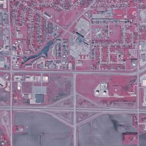
USGS topographic map, 1965 photorevised 1972 / Aerial photograph, 2002
San Marnan/412 is the road running roughly horizontally across the middle. Purple on the left map indicates something built between 1965 and 1972. (Waterloo-area topo maps available from the USGS are from 1965/72 at the 1:24,000 scale and 1982-ish at the 1:100,000 scale. You'd think they'd get updated more often.) The significant structure in the upper middle is Covenant Hospital (formerly St. Francis). Waterloo had a significant period of expansion/"urban sprawl" with development down to San Marnan between 1965 and 1985; only since 2000 has there been significant expansion south of a horizontal line that extends due east where San Marnan goes northeast (the extreme right of these shots).
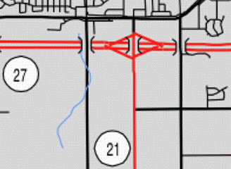
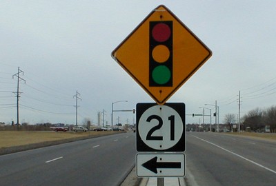
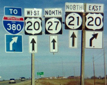
This color surface map of Black Hawk County from the DOT's website expressly stops the red line for IA 21 at the north side of the interchange. Indeed, that's where the sign is, as we can see below:
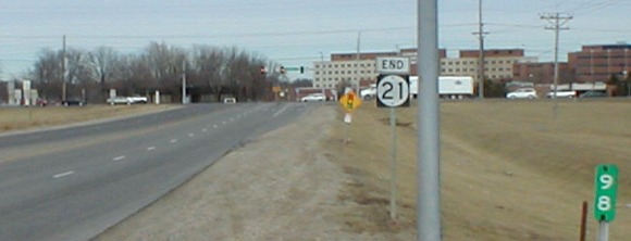
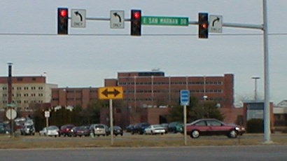
Facing north on 21 (1/9/02)
This picture was taken standing at the end of the exit ramp for 20 westbound. Notice that 21 is almost exactly 98 miles long. To the left of the stoplight you can see a silvery car. In front of that car is the back of a "Jct 20/27" sign, which in the fall of 2004 was replaced with an oversize "Stop Ahead". On May 19, 2004, three-way stops were initiated at both sets of ramps, meaning that traffic on 21 had to stop twice. Those were replaced with stoplights later. In fact, until then IA 21 was Iowa's longest state route without a full-fledged stoplight. (There is one in Belle Plaine that is triggered by cross traffic and pedestrians, but is not on a regular cycle. There's also a light to the south at Hawkeye Community College now.)
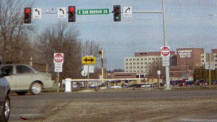
Facing north on 21 (1/9/02)
That purple car is on a frontage road, but you can't get to it. "Why in the world is that?" you ask. Well, because it is. That blue sign directs you to Covenant Medical Clinic, which happens to be that brick building in the background. Ambulances have had to negotiate two left turns, one immediately after the other, and endure a mile-long detour. That car is only feet from the light pole, if that.
Facing north on 21 (12/19/03)
Since the above picture was taken, an ambulance path has been built (seen here). However, in order to use it, crews must have a $1500 controller to freeze the lights and open a crossbar. Because of this, Dysart, Traer, Reinbeck, and other small towns south of Waterloo are no better off.
Note that two lanes turn left, and one goes right, the third appearing to have been added later (see the 'End' picture). I've often wondered why this is so, since until the early 2000s the commercial area of San Marnan was to the right, between here and US 218.
Facing west on 412 (San Marnan) (1/9/02)
The left-turn lane was extended in 2001; if you squint you might be able to tell the old pavement marking where the lane began. This assembly is missing a "Jct" or "To" sign, though. Signage on the stoplights indicating "US Highway 21" was short-lived and disappeared by mid-May 2002. Compare the land in the background of the left side to the land below, 16 months later:
Facing east on 412 (San Marnan) (5/20/03)
The Fazoli's, Lowe's, and right-turn lane in the foreground were all added between January 2002 and May 2003. Note that these signs pick up 21 right away (no "To").
January 9, 2002, was an overcast day; pictures from that day below have had their colors changed a bit.
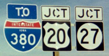
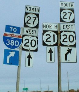
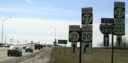
Junction US 20/IA 27
Facing east on 20, but heading south on 27 (11/9/01 and 11/20/06)
Both BGSs for 21 on 20 eastbound. At lower right of the right picture is the final sign for the 21 exit. The I-380 shield on the BGS has "Iowa" in it and is the size of a 2di shield. Original signs along the US 20 freeway, prior to the addition of exit tabs, had "Exit" at the bottom.
Facing east on 20, but heading south on 27 (11/20/06)
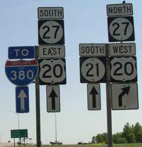
Facing west on 20, but heading north on 27 (5/20/03)
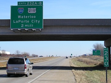
Instead of at the mile mark, 20 westbound's sign for 21 is at the interchange with I-380 and US 218. Notice that in this direction, the exit tab corresponds to I-380. The overpass is for I-380 SB traffic, coming off 218 to join 20.
Facing west on 20, but heading north on 27 (7/15/07 and 7/25/07)
Facing west on 20, but heading north on 27 (7/25/07)
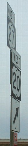
The 20-21 interchange as seen on 21
Facing north on 21 (12/19/03)
The signs heading north on 21 at this interchange are a case study in sign poles and supports. This assembly is a replacement for past ones with new 380/20 shields and put all in a row after the old arrangement had tipping problems; the narrow 20 here was the first at the interchange. (A suggestion: Perhaps unified single-panel green-background signs are the way to go.)
Facing north on 21 (1/9/02 and 12/19/03)
Every interchange between 58 south and 380 has signs for "To I-380". The shields for 27 were added in fall 2001. The right 27/20 set in the two pictures was tilting slightly right in November 2001 and fixed by January 2002, only to later come under assault from the left assembly crashing into it by March 2005. ("North" above 27 is now scraping the 21 shield, but the 27 below it has slipped behind the 21.) Note the "North 21" shields.
Facing north on 21 (12/19/03)
All LGSs replaced Cedar Falls with Fort Dodge after the completion of the freeway in Grundy and Hardin counties. An LGS on 20 west of here now lists Fort Dodge under Hudson and Cedar Falls.
Facing south on 21 (5/20/03)
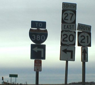
This is the first sign for 21 on 21, following a "Jct 20/27" (which is now a "Stop Ahead"). Compare the "2" digits; 20 is in Series D. The entire right pole had disappeared by March 2004, but presto changeo...
Facing south on 21 (3/15/05)
The stop signs on 21 can be a major pain. However, traffic has become so heavy that they are merited as a stopgap before a stoplight. It's hard to get good shots of some signs in this area because of that (to be honest, that's why the End photo at top hasn't changed).
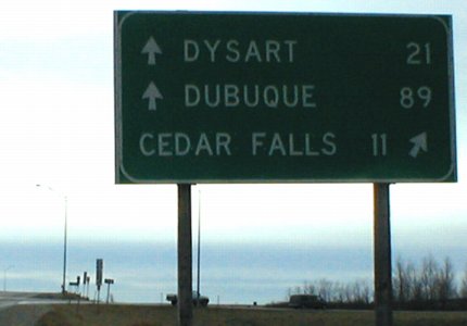
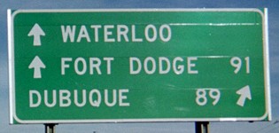
ABOVE: LGS in background of above picture; bottom has changed to "Fort Dodge 91" (1/9/02)
LEFT: Instead of redoing the post, many 27 signs were tacked on like this - and later rearranged into a horizontal setup.
Sign assembly in far background of LGS picture (1/9/02)
Nearly all of these assemblies have change in some way or another in the past two years. About 3/4 of the 27 shields on top have been moved to the sides. The 21 pole in this picture has now (March 2004) vanished; it is now a set of poles with 380, 20, and 27 shields side-by-side, all with an ahead-and-left arrow under them.
*Inaugural Highway End*
Point of interest
In the late 1950s the extension of 21 north from IA 8 to a proposed US 20 bypass were in the works - and 21 was going to be a four-lane highway, Iowa 402. The Traer Star-Clipper ran a graphic showing where roads would be closed, bridges built, and interchanges made. Instead, only two lanes were completed, and Waterloo got its connecting four-lane with I-380. The DOT, though, had already bought the land...
Facing north on 21 (1/9/02)
This is right at the Waterloo city limits (see right side). Notice there are two fence lines: One where the bushes are, another about halfway between the bushes and the shoulder. Many farmers along the side have reclaimed their land and others have not. In many places, two fence lines are visible, especially where trees are.
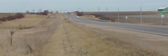
Facing south on 21 (1/9/02)
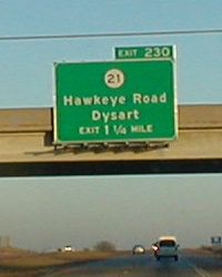
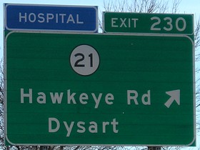
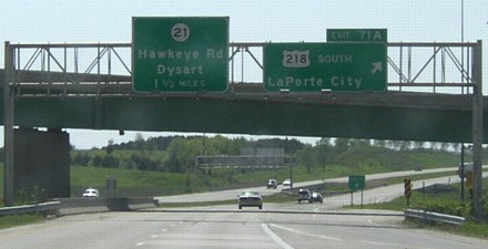
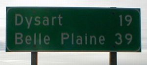
This picture is from only a few feet behind the above picture. Yes, those are the next two towns on the route. Five of the six incorporated towns along 21 are on BGSs, Dysart on 20 and the rest on signs along I-80.
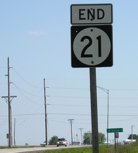
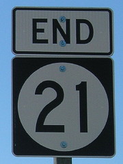
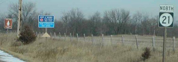
Old SOUTH End: Stop sign, IA 92, Keokuk County
Facing south on 21 (7/15/19)
Facing south on 21 (7/15/19)
This intersection, which has retained the grassy medians of an older intersection design, will lose those medians when the intersection is rebuilt in 2022.
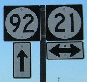
Facing east on 92 (7/15/19)
Facing north on 21 (7/15/19)

Facing north on 21 (7/15/19)
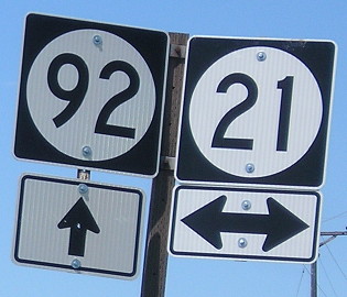
Facing west on 92 (7/15/19)
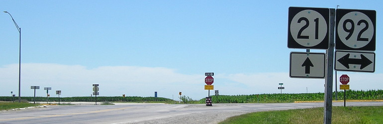
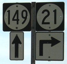
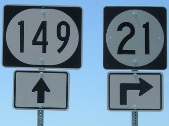
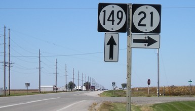
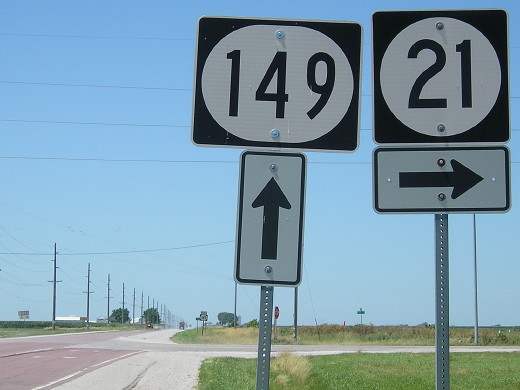
SOUTH End: T intersection, IA 149, Keokuk County
A somewhat unique circumstance - a north-south highway ends at a north-south highway!
Facing south on 21 / Closeup (5/10/05 and 7/15/19)
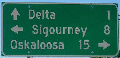
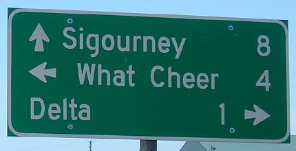
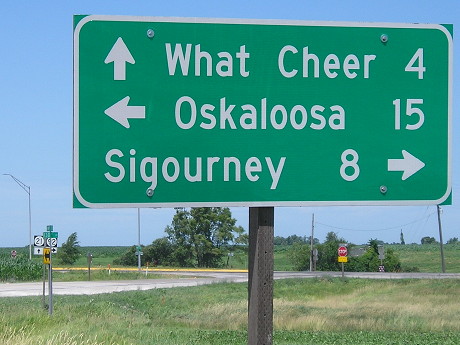
This end is much more characteristic of an Iowa highway - and there's no ambiguity as to where it is. However, the pavement dates back to when this was a county road - 1965 - and the mileage signs around this intersection leave something to be desired. (Ottumwa would be a logical addition to this LGS.)
Facing south on 21 / Closeup (5/10/05 and 7/15/19 and 7/15/19)
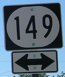
I find the wide shields with narrow lettering aesthetically displeasing.
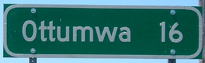
Facing east, but heading north, on 149 (5/10/05)
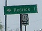
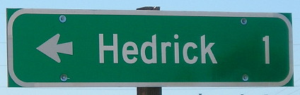
In Hedrick, up ahead on 149, the leaving-town LGS still includes Cedar Rapids.
Facing east, but heading north, on 149 (5/10/05)
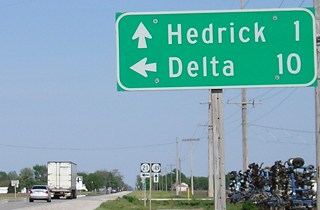
Facing west, but heading south, on 149 (5/10/05 and 7/15/19)
The ahead-and-turn isn't standard, yet was replicated in the sign replacement.
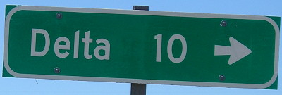
Facing west, but heading south, on 149 (7/15/19)
The LGS in this direction only lists Delta, again not mentioning Ottumwa, but then there's a sign after the intersection for Ottumwa, which is weird.
Facing west, but heading south, on 149 (10/13/06)
Facing west, but heading south, on 149 (7/15/19)
Facing north on 21 (1/20/02)
Photo by Neil Bratney
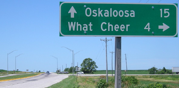
Only 98 miles to Highway 20.
Page created 12/16/01; last updated 1/29/10 3/18/20