
(April 9, 1935-June 14, 2016)
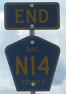
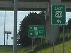
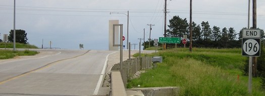
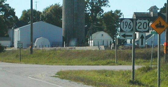
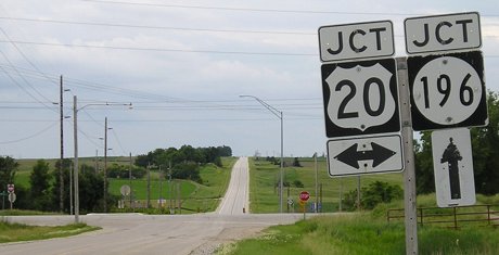
NORTH End: Interchange, US 20 and N14, Sac County
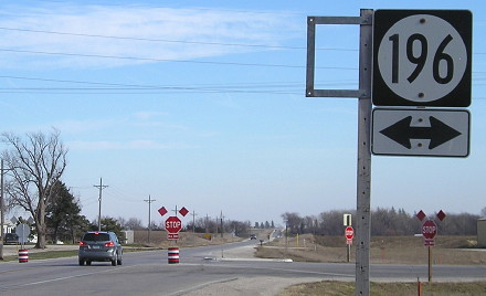
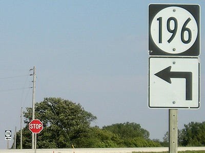
As IA 196
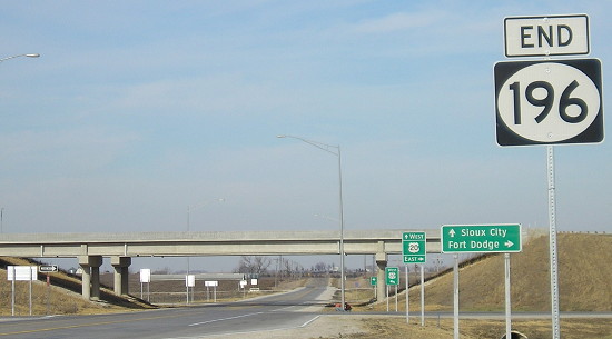
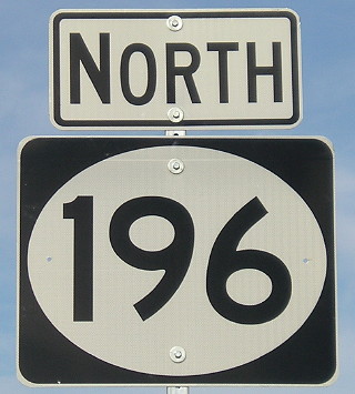
Facing north on 196 (11/23/12)
According to the March 24, 2006, Fort Dodge Messenger, the DOT told the US 20 Corridor Association it would not proceed with four-laning US 20 until the counties involved agreed to take over the old road. The only change the other way was to extend IA 196 northward to 20, which including rebuilding the county road from the ground up.
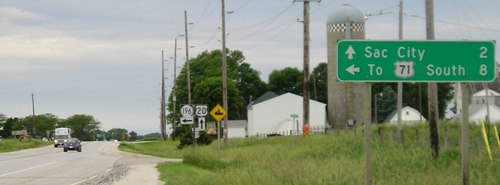
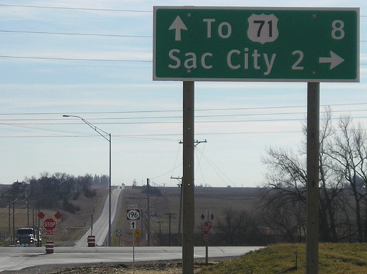
There are seven wide shields between new 20 and old 20, all put up by a contractor. This is the first widespread use of such shields in Iowa. The second came a month later with IA 330 shields extended down the diagonal to I-80.
Most of the signs pictured here didn't make it five years. The entire highway was rebuilt and US 71 rerouted up 196 and then west on 20.
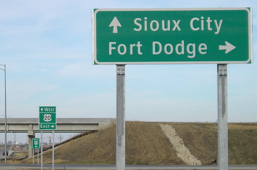
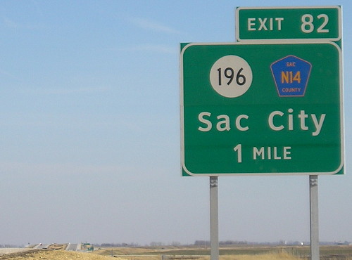
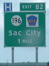
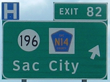
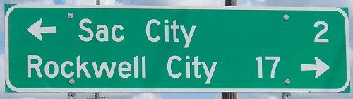
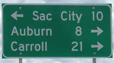
Mileage sign at end (11/23/12)
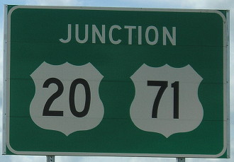
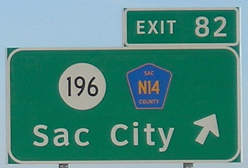
All the signs at the new 20 interchanges are the new style, green single-panel signs with no mileages given with the cities.
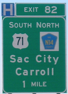
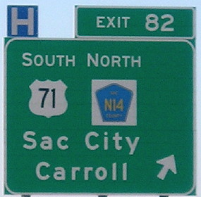
As US 71
Facing north on 71 (8/8/16)
Facing north on 71 (8/8/16)
Facing south on N14 (8/8/16)
Facing south on N14 (8/8/16)
As IA 196
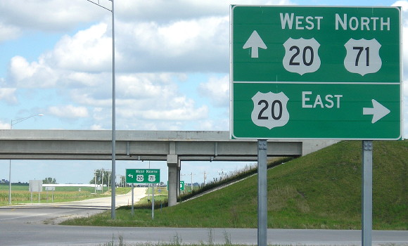
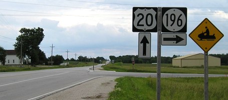
Facing east on 20 (11/23/12)
A brand new sign but it didn't get directional tags.
Facing east on 20 (11/23/12)
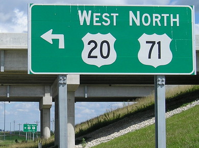
Facing west on 20 (6/4/14)
Facing west on 20 (10/19/18)
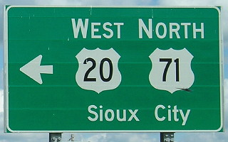
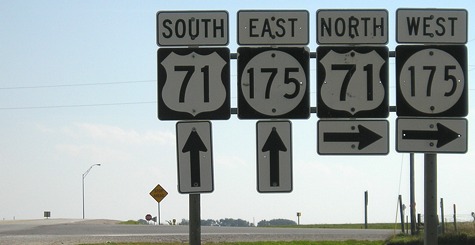
Yay, a perfect BGS with proper cardinal directions and all relevant roads marked.
Closeup of wide shield at old US 20 intersection (below) (11/23/12)
NORTH End (1952-2012): Stop sign, US 20 and N14, Sac County
Pre-extension
Facing north on 196 (9/20/02)
Photo by Neil Bratney
Originally, 196 turned west and then north to end at 20 just east of Sac City.
Facing north on 196 (6/12/05)
Facing north on 196 (6/12/05)
Facing east on 20 (6/12/05)
Facing east on 20 (6/12/05)
Facing west on 20 (6/12/05)
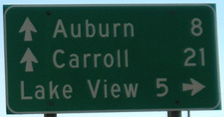
The creation of IA 196 was spurred by the realignment of US 71 through Lake View instead of going north on what today is M54 and meeting 20 at Sac City. Given the existence of a major route west from Lake View (IA 35, which later became IA 175) and IA 4 west of Early, I don't know the reasoning behind moving 71 over so it met 20 south of Early, instead of sending it north on today's 196 and making a US-US duplex through the county seat. (On the other hand, the realignment did decommission 4 between 20 and Odebolt.)
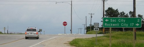
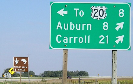
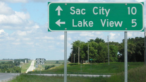
About these LGSs on 20, Neil writes, "IA 196's role as a cut-off become clear after looking at this distance sign from westbound US 20. No cities are along IA 196. Take it to get to US 71 south. If you want to go north on US 71, just keep going west on 20."
Facing west on 20 (9/20/02)
Photo by Neil Bratney
Facing south on N14 (6/12/05)
Post-extension
Facing south on 196, same spot (11/23/12)
Facing east on old 20 (11/23/12)
The intersection has been turned into a four-way stop. All the brackets and, for at least the time being, mile markers remained though. The shields on 196 south of the intersection remain square.
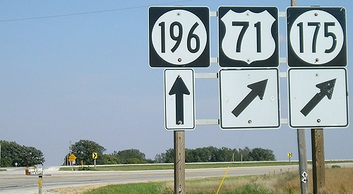
Facing north on 196, now US 71 (8/8/16)
The LGS has the same information as the 2005 sign, but in the new font.
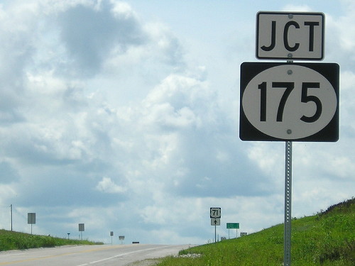
SOUTH End: Stop sign, US 71/IA 175, Sac County
As IA 196
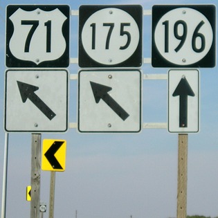
Facing south on 196 (9/20/02)
Photo by Neil Bratney
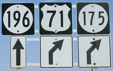
Facing south on 196 (9/17/07)
Facing south on 196 (9/17/07)
Facing south on 196 (9/17/07)
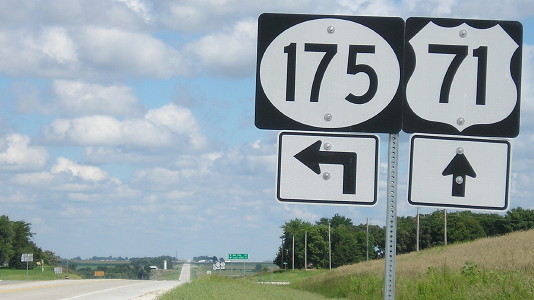
Series C + smaller wide font + Series D + small narrow font = a very varying sign arrangement.
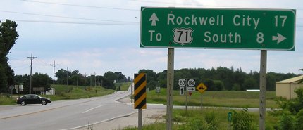
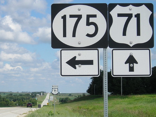
Facing north on 71, but heading west on 175 (9/17/07)
There's no signage for 20 here most likely because 71 went four miles westward before it turned north. Here the combined 71/175 route goes west again.
Facing north on 71, but heading west on 175 (9/17/07)
Facing north on 71, but heading west on 175 (9/17/07)
Facing east on 175, but heading south on 71 (9/17/07)
Facing east on 175, but heading south on 71 (9/17/07)
Although southbound 71 already intersected 20, 175 didn't, and one could still go north on 196 and then east on 20.
Facing east on 175, but heading south on 71 (9/17/07)
Facing east on 196 (9/17/07)
The south end of 196 is like the west ends of 363 and 383. The main road curves away from the four-way section line intersection while another road runs into the other route. This road comes from southbound 71/175 (with the "Stop Ahead" in the picture above) and 196 goes to the left. A right turn ends up right back at 71/175.
Then, as part of the reconstruction of the road and reroute of US 71, the intersection was turned into a conventional one.
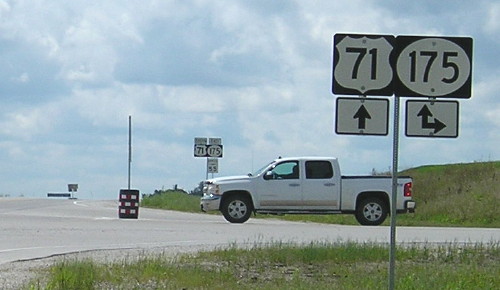
As US 71
Facing south on 71 (8/8/16)
Facing south on 71 (8/8/16)
Facing south on 71 (8/8/16)
The pickup truck is where the "196 [ahead and left]" was.
Facing north on 71 (8/8/16)
Because the curve was taken out, this is a bit north of where 175/71 curved away from the north-south road.
Facing north on 71 (8/8/16)
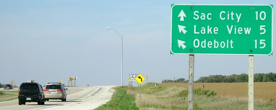
Before and after the change, Sac City was the northbound destination, but it's not on the north-south road. However, the next realistic options would be "To 20" and Storm Lake, now that 71 runs north from here.
Facing north on 71 (8/8/16)
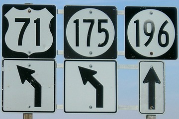
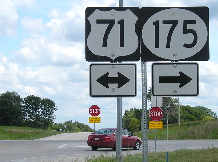
All the shields at this intersection are the new MUTCD standard, including the wide-shield 175.
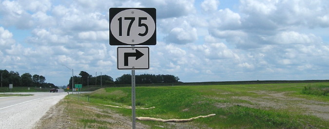
Facing east on 175 (8/8/16)
Here you can see the roadbed for the curve that was taken out.
Facing east on 175 (8/8/16)
Facing east on 175 (8/8/16)
Page created 5/2/04; last updated 3/18/19