
| IA 191 endpoint history | |||
| FROM | TO | SOUTH | NORTH |
| 12/1/30 | 6/4/35 | IA 7, later IA 64 (G8L at G18, which in 1959-2003 was the west end of IA 83) |
IA 39 (IA 191 at IA 44) |
| 6/4/35 | 6/20/37 | Panama | |
| 6/20/37 |
1941 |
IA 37 (Elmwood Rd at IA 37) | |
| 1941 | 1953 |
IA 37 in Earling | |
| 1953 | 8/12/59 | US 59 (F24 at old US 59) | |
| 8/12/59 | 1/1/69 | IA 64 in Portsmouth (IA 44) | |
| 1/1/69 | 10/20/81 | US 6 (IA 906) | IA 37 in Earling |
| 10/20/81 | 7/1/03 | NCL Council Bluffs | |
| 7/1/03 | Present | I-680, later I-880 | |
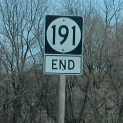
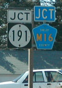
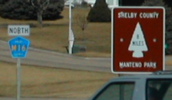
NORTH End: Stop sign, IA 37 and M16, Earling, Shelby County
Facing north on 191 (1/15/02)
Photo by Neil Bratney
Neil says that 191 "enters the west side of Earling from the southwest. The terminus is at the very southwest corner of the city. Highway 191 turns sharply to the due north, just feet before its terminus."
Sign and LGS at extreme left of top picture (1/15/02)
Photos by Neil Bratney
Replacement signs for Neil's pictures (7/24/19)
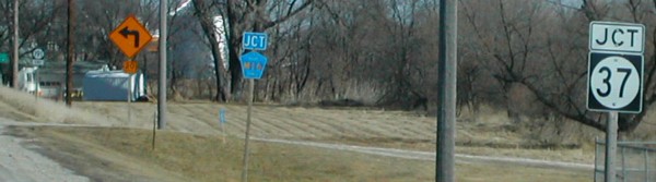
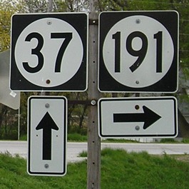
Facing west on 37 (1/15/02)
Photo by Neil Bratney
The "Jct M16" isn't exactly true because M16 is sharing the road with 37 at this point.
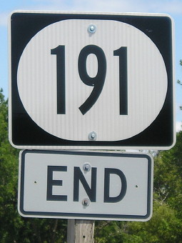
Facing west on 37 (5/7/06)
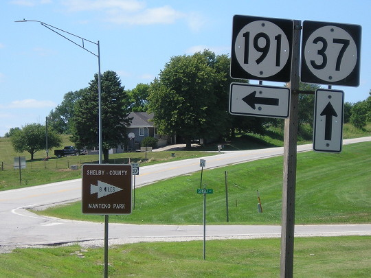
Facing west on 37 (7/24/19)
Notice the wide font on the 191 shield. WHY CAN'T THEY DO THIS ON THE WIDE ONES??
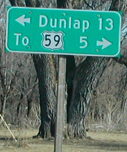
Facing north on M16 (1/15/02)
Photo by Neil Bratney
(The brown signs in the above two pictures are for the same destination.)
Facing east on 37 (5/7/06)
Facing east on 37 (5/7/06)
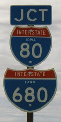
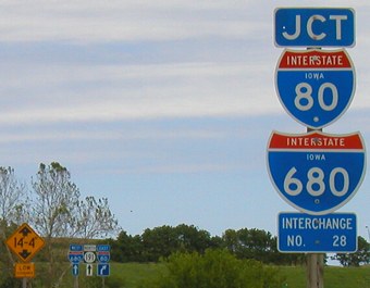
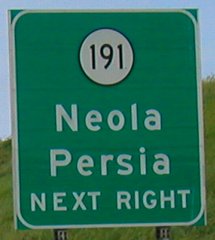
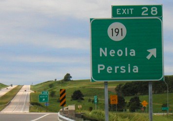
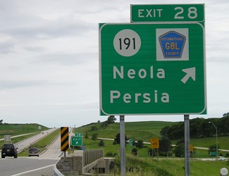
SOUTH End: I-680 exit 28 and G8L/Old IA 191, now I-880 exit ??, Pottawattamie County
The June 2003 pictures were taken three weeks before IA 191 was truncated to this intersection; the August 2019 pictures were taken three months before part of I-680 became I-880, a change that will be acknowledged here and no further.
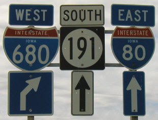
Facing southwest, but heading south, on 191 (6/9/03)
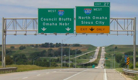
This interchange signage was interesting before decommissioning (and later, generification of signs) because it made you think you were meeting two interstates at once. Technically, 191 only meets 680. However, the 80/680 interchange is just to the east. These two assemblies are beside the Tri-County School District building. Tri-County is nominally of Neola but the school is three miles outside of town, much like Wapsie Valley of Fairbank. The Harrison County line is a stone's throw away from these signs.
Facing southwest, but heading south, on 191 (6/9/03 and 8/11/03)
Actually, if you take the ramp you will be on 680 and have a chance to decide to go east or west on 80.
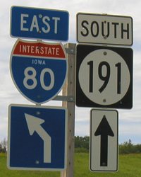
Facing southwest, but heading south, on 191 (6/12/05)
The "East 80" is the same in all three pictures.
Closeup of signage (6/12/05)
Facing west at end of offramp; replacement for sign at right in above picture (7/24/19)
Facing southwest, but heading south, on 191 (7/24/19)
Facing southwest, but heading south, on 191 (7/24/19)
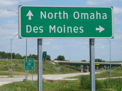
The previous setup had multiple signs pointing to I-80, and basically disavowing 680's existence to the east, but now there are no mentions for I-80 at the exit.
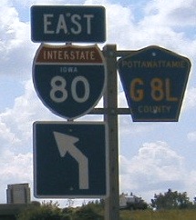
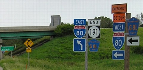
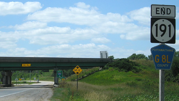
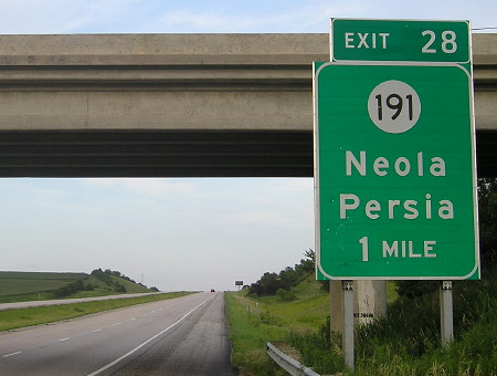
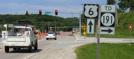
Facing northeast, but heading north, on 191 (6/9/03)
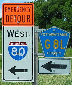
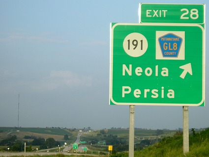
Facing northeast, but heading north, on G8L (7/24/19)
Facing northeast, but heading north, on G8L (7/24/19)
Facing northeast, but heading north, on 191 (6/9/03 and 7/24/19)
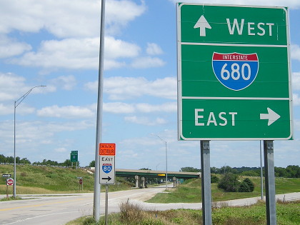
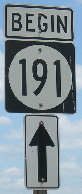
Notice the "Junction 80 1/2 mile" BGS for 680 at far left. The "North 191" from 2003 became a "Begin 191", the only northbound shield left.
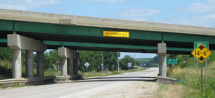
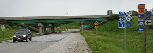
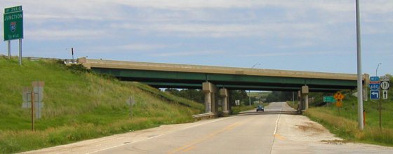
Facing northeast, but heading north, on 191 (7/24/19)
This is a closer view of the bridges, and previously had been marked as a 14'4" clearance.
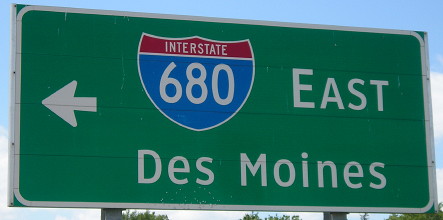
Facing east on 680 (7/16/14)
Facing east on 680 (7/29/07)
In the second-biggest sign typo in recent history, this exit points to County Road GL8 instead of G8L.
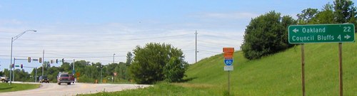
I-80/I-680 westbound
The following pictures are in order as you go west:
Facing west on 80 before the 680 interchange (6/9/03)
Facing west on 80 (6/9/03)
The interchange with 191 is prominent in the background.
Facing west on 680 (6/9/03 and 6/12/05) (side-by-side if browser window is wide enough)
This is one of the few interchanges that bothered to have county shields put up when state highways were changed.
Old SOUTH End (October 20, 1981-July 1, 2003): City limits of Council Bluffs, Pottawattamie County
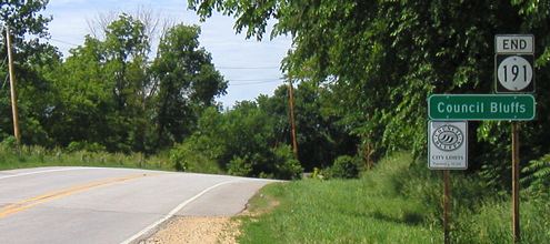
Facing south on 191 (6/9/03)
The city-made city limits sign was not posted in early 2002.
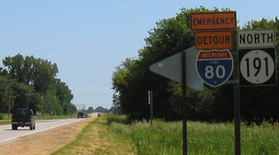
Facing north on 191 (6/9/03)
This is the first sign heading north on 191, also marked as an "Emergency Detour" for I-80. (As to what emergency, I really don't know.) County roads are still allowed to be emergency detours.
Old SOUTH End (January 1, 1969-October 20, 1981): Stoplight, US 6/E. Kanesville Blvd., Council Bluffs, Pottawattamie County
Facing southwest, but heading south, on 191 (6/9/03)
Facing east on 6 (6/9/03)
The LGS has seen better days, probably unreplaced since this was no longer an intersection (yet the one facing south seems relatively new).
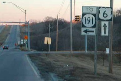
Facing east on 6 (1/15/02)
Photo by Neil Bratney
This intersection is a mile south of 191's present end - the portion inside the city was turned over in 1981 - and a mile east of 6's first interchange with I-80 in Iowa. This sign assembly was not up in 2003 (see above).
Facing west on 6 (6/9/03)
Facing west on 6 (6/9/03)
The street sign on the light says "Hwy 191 ->" but the sign assembly now says "Jct G8L ->".
Page created 3/31/02; last updated 11/12/07 4/10/20