 WEST
WEST
WEST End: Stoplight, US 69/E. 14th St., Des Moines, Polk County
Iowa 163's roots go back to US 63, which originally ended in Des Moines. After 63 was rerouted north of Oskaloosa, the route was renamed US 163, which was only around for less than four years before being demoted to a state highway. It still deserves the number more than that impostor in southeastern Utah, though. See more information about US 163 below.
Facing west on 163
Facing west on 163 from concrete island
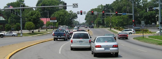
In December 2001, the stoplights were strung up. It looks better now. Notice the double left-turn lanes.
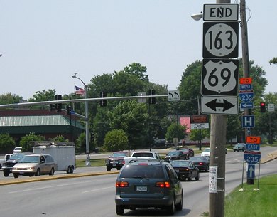
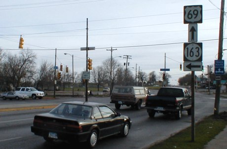
Facing north on 69 (December 2001 / July 2005)
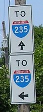
Oops! Just south of University Avenue is where 69 splits into southbound 14th Street and northbound 15th Street. As the two roads come together again, you used to see this sign (left). It should read "Jct 163". Now, though (right), it's completely out of whack. East 65 with interstate colors? Maybe I-235, but not 65.
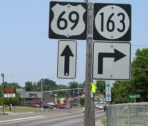
Facing north on 69 / Background signs
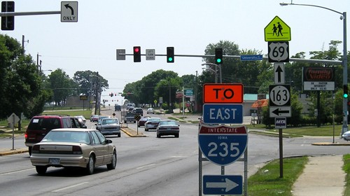
Oops, they did it again, sort of. The arrow under the 163 often implies that a road has been traveling along on that road and is now splitting. (However, it does sometimes imply that the turn is simply farther ahead, so this is only sort of a goof.) As per usual practice, the 163 sign shouldn't be here, instead just a sign showing where the current route (69) is going (straight ahead).
Facing north on 69 (December 2001)
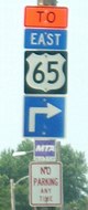
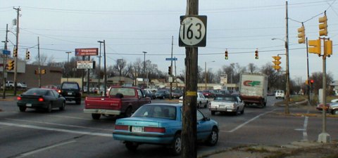
And one more oops, just to make sure all the bases get covered. This shield is on 69! The correct assembly would have a 69 shield with a straight arrow and a 163 shield with a right arrow. The blue car, once it finishes its turn, will be on 163. An e-mail a while back told me this sign has been removed, and replaced (temporarily?) with a sign near the ground:
Facing north on 69 (July 2005)
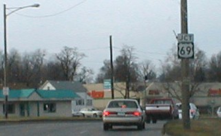
Facing south on 69 (December 2001)
The white SUV on the left is at the end of 163. Notice that all the lights at this intersection are strung rather than on poles; this has since changed (see top pictures and below).
Facing south on 69 (July 2005)

At first, I thought that the above intersection was also the western terminus of old US 163, and US 63 before that. I had thought that US 65 and/or 69 came into Des Moines and went on 14th Street, using the 14th Street bridge. Then Neil Bratney posted a 1935 map of Des Moines and I found out, in the words of Marty McFly, "According to the map...there is no bridge."
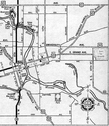
From ISU Parks Library map collection
This map is not Neil's; it's from 1937, but it shows the same information. On the map, US 65 and 69 come up from the south on Indianola Avenue and then use Seventh Street. Then it appears some one-way streets are used in downtown and 65 and 69 come east on Grand Avenue with "City US 6". In 1934, the latter had been actual 6 before moving to today's route on Merle Hay Road and Douglas and Euclid avenues. At 14th Street, 65 and 69 turn north, on the route 69 uses today.
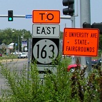
Jason Hancock's excellent research into Des Moines highway history has clarified the issue, and brought a few surprises with it. He has determined that the original end of US 63, and then US 163, was Grand Avenue at East 14th Street, a few blocks east of the state capitol and today a scant distance from I-235. The signed route went east on Grand, north on East 30th Street, and then east on University Avenue, skirting the west and north sides of the fairgrounds. By about 1945, changes had put 163's west end where it is today.
US 163 lasted a little more than 30 months - December 1934 to July 21, 1937 - but if you look hard enough you might find a trace of it - sort of...
For a short time in the mid-1990s, US 65 was routed on 163 from the bypass to its (pre-bypass) route through the city with US 69. I think that was when little shields were added to the first three mile markers on 163...but they got the wrong shape.
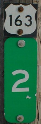
Facing east on 163, near the state fairgrounds
I didn't know mile-marker shields lasted over sixty years. :-) The right picture is a closeup of the shield above the "2". These US 163 mini shields are in both directions at mile markers 1, 2, and 3.
All pictures by me: First, second, fourth, fifth, seventh, and ninth, 7/10/05; third, sixth, eighth, tenth, and eleventh, 12/21/01
Page created 2/17/02; last updated 6/9/07