
(February 14, 1933-October 20, 1980)
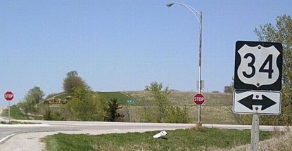
NORTH End: Stop sign, US 34, Adams County
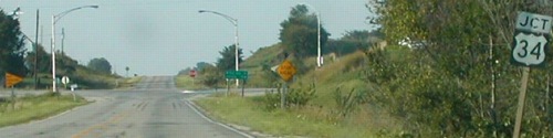
Facing north on 155 (9/2/02)
Photo by Neil Bratney
While IA 155 always ended at US 34, it didn't always end at the same place. When a long new alignment of 34 was completed in 1965, the northern third of the route was lopped off (up to what is now H34).
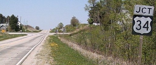
Same view later (4/23/06)
Photo by Jason Hancock
Since Neil's pictures here, the mileage sign and mile markers, plus two streetlights, have been removed.
Facing north on 155 (9/2/02)
Photos by Neil Bratney
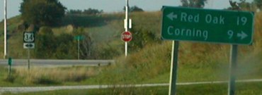
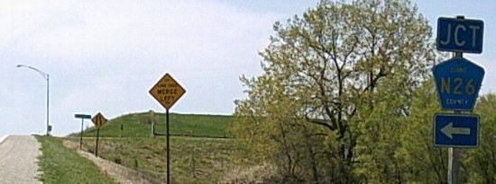
Although 155 was supposedly decommissioned in 1980, it shows up on the 1981 map. For the next 20 years, mile markers and DOT-style signage appeared at the north end, including the split of "Jct" and double-arrow assemblies.
Facing north on 155 (4/23/06)
Photo by Jason Hancock
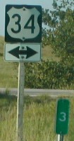
Facing west on 34 (4/23/06)
Photo by Jason Hancock
On the 1965 stretch of US 34 between Hastings and Corning, there are quite a few three-lane segments, generally approaching hills. At one time, the idea was eventually to make 34 a four-lane road.
Facing west on 34 (4/23/06)
Photo by Jason Hancock
Facing east on 34 (8/16/16)
SOUTH End: 7th Ave., Nodaway, Adams County
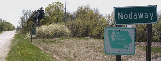
Facing south on 155 (4/23/06)
Photo by Jason Hancock
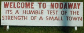
The speed limit sign in the background dates back to 155's time as a state highway, though the city sign in the foreground may not.
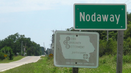
Facing south on 155 (8/16/16)
After another decade of wear, the Community Betterment sign has become almost a photographic negative of itself. Also, mostly hidden, the speed limit sign has been replaced.
Facing north on 155 (4/23/06)
Photos by Jason Hancock
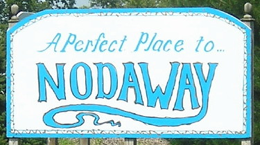
Facing north (9/2/02 and 8/16/16)
Left photo by Neil Bratney
The new slogan, at right, doubles as a pronunciation guide.
Facing west, but headling south, on 155 (4/23/06)
Photo by Jason Hancock
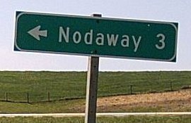
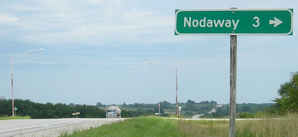
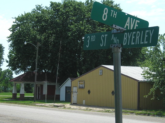
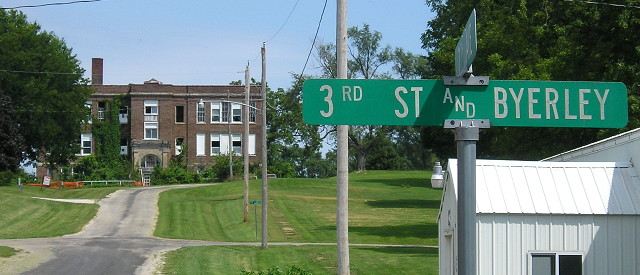
Jacon writes, "I followed the remaining mile markers into Nodaway, but noticed a pavement change one block north of where the mile markers count down to. Thus, the south end was most likely here, in what passes for Nodaway's business district. IA 155 followed 8th Avenue for one block to end here at '3rd Street and Byerley.'" However, as it turns out, the mile markers were correct and the end was a block to the right. The post office is the brick building at left. Well, it was...
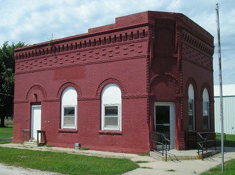
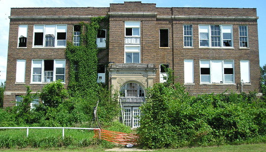
Nodaway lost its post office in 2011. (8/16/16)
Facing south-ish
When Jason said the intersection was "3rd Street and Byerley," he wasn't kidding. This is partially looking on the last block of 155, where there isn't much to see anymore. The building at left has the style of an old gas station. The 1912 Huebinger guide to the Blue Grass Trail, which largely became US 34, mapped the route through Nodaway. The route deviated from present-day N26 by using 4th Avenue, "3rd St and Byerley", and 5th Avenue to run through downtown Nodaway, passing three gas stations, a livery, a blacksmith shop, and a bank.
Facing east (8/16/16)
The start of 155 was to the left. But looking this way...I see catnip.
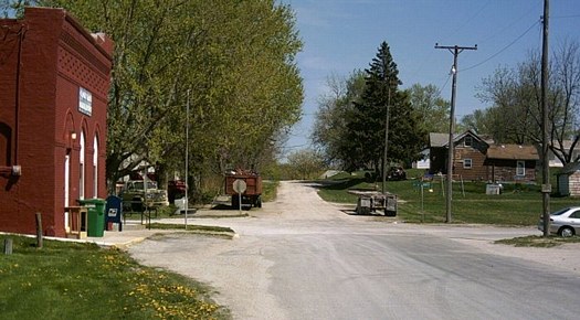
This is what 30 years of abandonment looks like. (8/16/16)
Last seen: 1980 (1981 map)
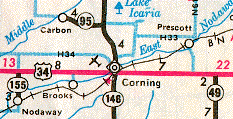
This map shows three things: 1) IA 95; 2) IA 155, decommissioned in 1980 but still on the map; and 3) the break in US 34's mileage, incorrect for the first time, at old IA 186 to Prescott, still there until the 2004 map. The presence of 155 here, like about 10 other highways, indicated the transfer of jurisdiction likely occurred after October 1980.
Page created 11/28/02; last updated 1/24/17