
(1980-April 2015)
WEST End: I-35 exit 36 and R35, Clarke County
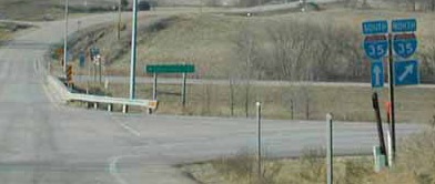
Facing west on 152
Photo by Neil Bratney
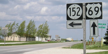
Highway 152 just barely edges out to be an east-west highway; the north-south distance between its ends is about .7 miles and the east-west distance is .9 miles as the crow flies. Its total length is about 1.3 miles. Its sole purpose is to connect I-35 and US 69 where they are the smallest distance apart.
Facing west on 152
Facing west on 152
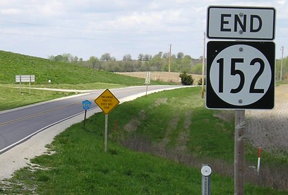
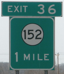
This is one of only four 152 shields on the entire route. The others are the east "End" sign and one in either direction at the route's beginnings. The photos above are different now, because the Iowa DOT is taking a new and definitely not improved tack on interchange signage:
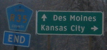
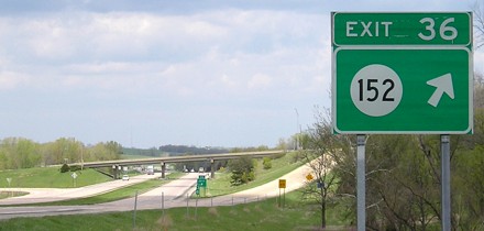
Facing east, but heading south, on R35
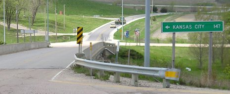
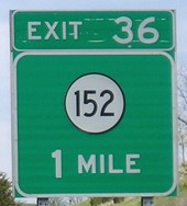
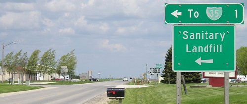
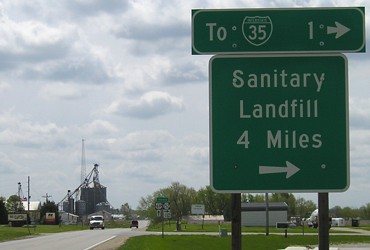
With the left sign, we lose the interchange number that used to be tacked on underneath. With the right sign, we lose the mileages to the control cities. Not only that, but the sign on the right, with just Des Moines and Kansas City, appears where the sign in that place used to include other destinations on the route intersecting the interstate. The sign that appears in sequence between these two is below.
An honest comparison here...
LEFT: Camera bought in 2005. RIGHT: Camera bought in 2009.
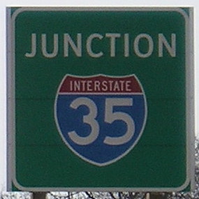
I used the April Fools' Day trip to do the closest thing possible to a controlled study of digital cameras: I took pictures of many things with both, so they dealt with the same lighting conditions and other factors. Here, the cameras are facing a still-eastward sun. While the older camera loses some smoothness around the I-35 shield, and is a bit more pixelated in general from the zoom, notice that its green is closer to reality than the bluish-tinged newer camera. In addition, the newer camera appears to have focusing issues worse than the old one when standing still. (Or I admit I could be too impatient.)
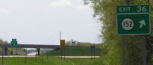
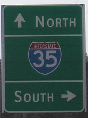
Facing south on 35
This sign, simple as it is, would be more accurate if it read "East 152; North R35". At least that would make the sign wider than the exit tabs. :-)
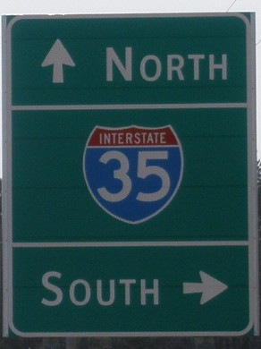
Facing north on 35
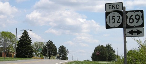
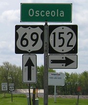
SOUTH End: Stop sign, US 69, city limits of Osceola, Clarke County
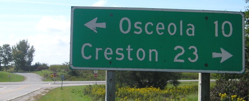
Facing east on 152
The speed limit on the entire route is 45 MPH, with no shoulders. There is also a greater number of houses along it than would be in most rural areas, in part due to its proximity to Osceola.
Facing north on 69
Facing north on 69
Facing south on 69
Of course Osceola isn't in Osceola County. That would be too obvious.
Surrounding area information: Old, old IA 152
Facing south on R16
The IA 152 number was recycled to R35 from a spur to Murray. The segment inside Murray was maintained as IA 929 until the Second Great Decommissioning.
Top picture by Neil Bratney: 1/20/02
Pictures by me: Second, third, and ninth-sixteenth, 4/25/05; fourth-eighth, 4/1/10; 17th, 9/17/14
Page created 1/13/02; last updated 9/29/10