
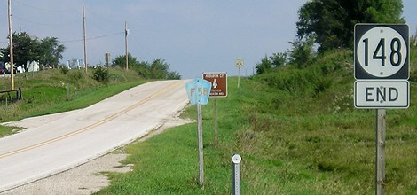
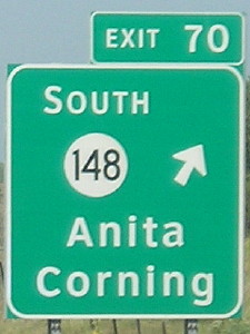
NORTH End: I-80 exit 70 and F58, Cass County
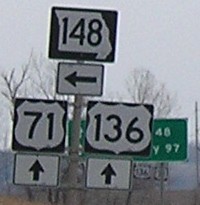
Facing north on 148 (8/21/06)
This exit is the closest one to the halfway point between Council Bluffs and Des Moines. US 6 was not signed here until the mid-2000s.
Facing north on 148 (8/21/06)
Highway 148 ends less than half a mile south of the Cass/Audubon county line. F58 continues north. The "End" sign is on the north side of the intersection. There is no signage for 148 on F58 southbound. (Eight years later, that county road pentagon was bleached white.)
Facing south on F58 (5/22/14)
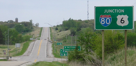
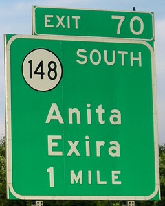
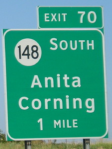
Here is the generic signage that is now the standard at Iowa interchanges.
Facing south on 148 (5/22/14)
None of these new signs show anything for IA 148.
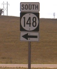
Facing west at offramp (8/11/03)
The road in the background is the onramp to westbound 80. F58 is not signed here or on the BGSs (see below).
Facing west on 80 (6/12/05)
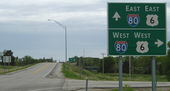
Compare the shield outlines and the spacing of the word "mile" with the eastbound signs below.
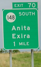
Facing west on 80 (8/21/06)
Facing east on 80 (6/4/07)
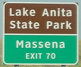
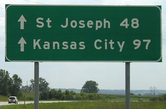
Villisca, Corning, Creston, and Mount Pleasant are on US 34 but mentioned on I-80.
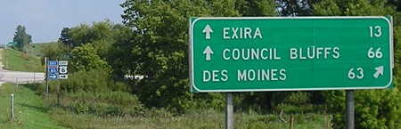
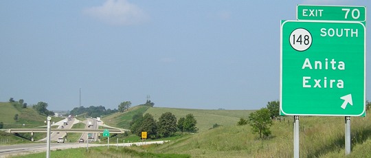
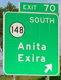
Exira has been demoted from second place on the BGSs, as seen below in the opposite direction five years later.
Facing west on 80 (7/20/12)
I-80 has been the north end of 148 since New Year's Day 1973; read more below.
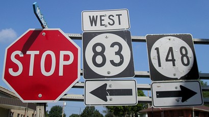
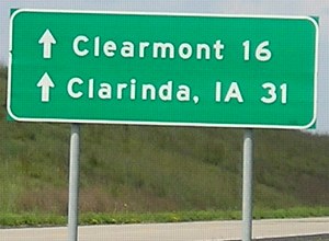
Old NORTH End: Stop sign, US 6 (now IA 83), Anita, Cass County
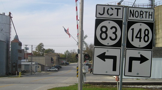
Facing north on 148 (10/22/14)
US 6, and before that US 32, was the highway in the distance.
Facing north on 148 (8/21/06)
In 1972, Cass County and the Iowa Highway Commission had a swap meet. The state gave the county the tiny spurs to Cumberland and Massena, IA 414 through Lewis, and US 6 east of Anita, while it took over the short county road connecting Anita to I-80. IA 148, which had just been paved south of Anita, was extended to the interstate. The road between US 71 and Anita was temporarily unsigned before becoming an extension of IA 83. Cass County got much more than it gave, but it was equalized somewhat eight years later when IA 173 was extended south from Elk Horn to IA 83.
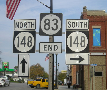
Facing northeast, but heading east, on 6, now 83 (10/22/14)
A short piece of 6 became 148 to where the road turned north. The reroute of 6 onto US 71 and I-80 took it away from Anita and Wiota.
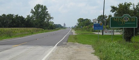
SOUTH End: Missouri state line, near Hopkins MO (8 miles SW of Bedford), Taylor County IA/Nodaway County MO
All pictures from here down taken 8/21/06 unless noted.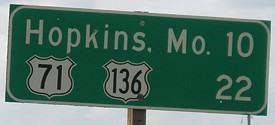
Facing south on 148 leaving Bedford
Facing southwest, but heading south, on 148
The entire route of MO 148 had fresh asphalt in summer 2006.
Facing southwest, but heading south, on 148
In addition to the fresh asphalt, 148 also had all wide shields.
Facing northeast, but heading north, on 148
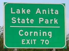
Though it is a long highway, and has been around a while, 148 only goes through three towns (Anita, Corning, Bedford) and skirts a fourth (Massena).
Old SOUTH End of MO 148: Stop sign, US 71/136 and Business US 71, near Maryville MO, Nodaway County MO
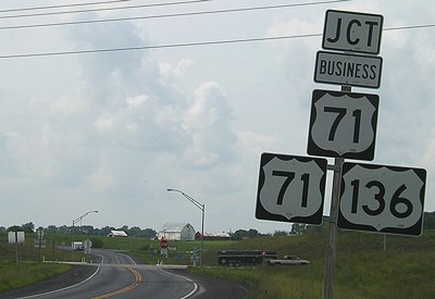
Facing south on old 148
Prior to the Maryville bypass, 148 turned west just before ending. From this perspective, US 71 would have gone ahead and to the right, at or right behind the camera. Today, old 71 is Business 71.
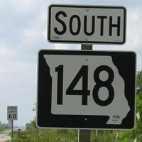
SOUTH End of MO 148: Stop sign, US 71/136, near Maryville MO, Nodaway County MO
Facing south on 148
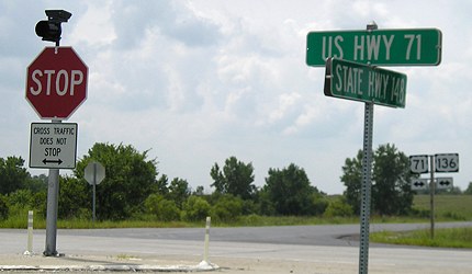
Facing south on 148
Despite the improvements to the road, there is no "End 148".
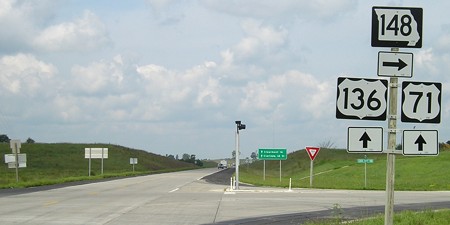
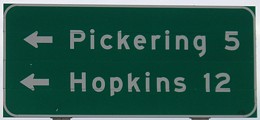
Facing west on 136, but heading north on 71
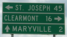
MoDOT does a very curious thing at this intersection: Instead of having mileage signs before the intersection, the signs are put up in each direction after the intersection. As such, no town on 148 gets mentioned at this intersection. ("Bedford, IA 22 ->" would be a possibility.)
Facing west on 136, but heading north on 71, sign visible in background
For that matter, no town on US 136 gets mentioned at this intersection either.
Facing east on 136, but heading south on 71 (4/6/08)
Facing east on 136, but heading south on 71
The most likely reason for no towns on 136 being signed here is that the next town on 136 to the east with a population above 5000 is Keokuk. (Bethany, at I-35, is 3087.) For comparison, I-80 is 81 miles north of here.
Page created 3/28/02; last updated 5/16/15