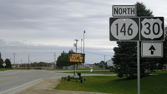
 NORTH
NORTH
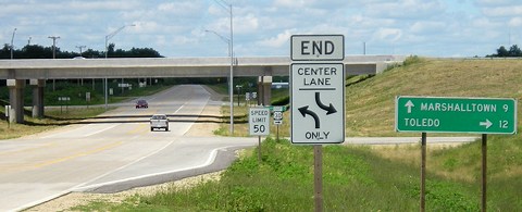
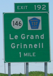
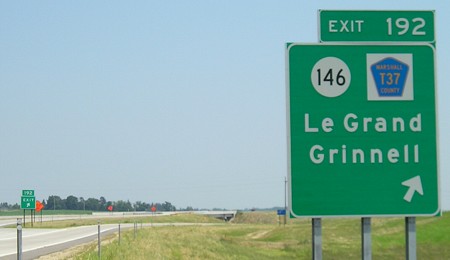
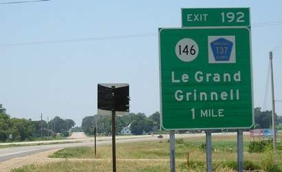
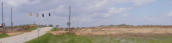
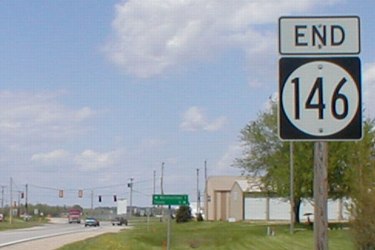
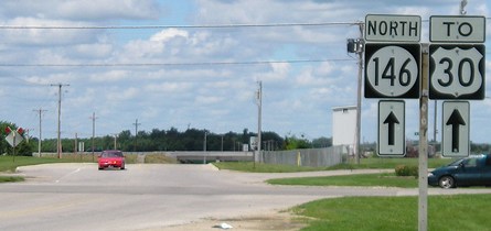
NORTH End: Interchange, US 30 and T37, Le Grand, Marshall County
Facing north on 146 (7/5/05)
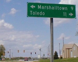
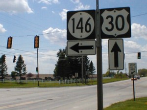
The signs at this interchange have weird arrows, and the arrow should go after the mileage.
Facing north on 146 (7/5/05)
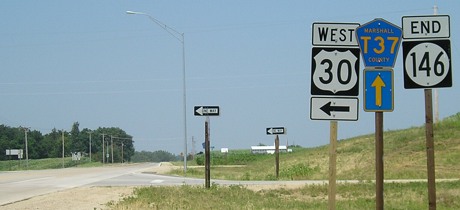
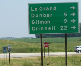
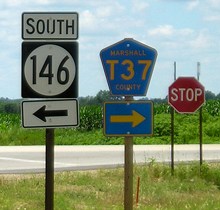
Facing south on T37 (7/5/05)
Facing south on T37 (7/5/05)
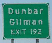
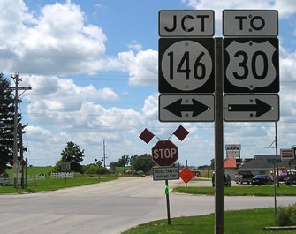
This sign is doubly wrong: The "ahead" city should be on top, and the right arrow should go after the mileage.
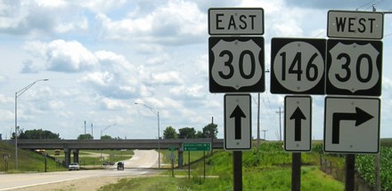
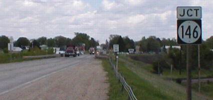
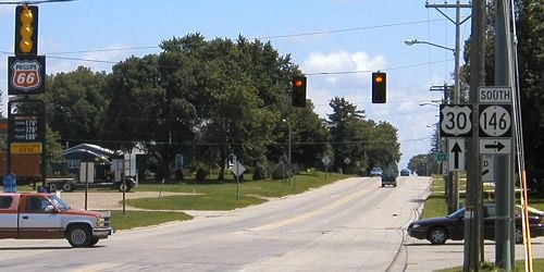
Facing east on 30 (7/5/05)
Facing east on 30 (7/5/05)
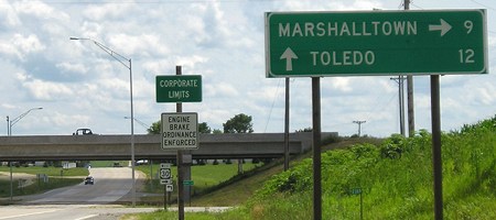
In the summer of 2005, the four-lane stopped here while construction continued to the east.
Offramp views: East / West (7/5/05)
Facing west on 30 (7/5/05)
The first BGS ever in Tama County - and, for the foreseeable future, the only. Every surrounding county got a BGS in or before 2000. To the left of the covered "Do Not Enter" sign is old 30 going into Le Grand, while new 30 curves behind the BGS.
Facing west on 30 (7/5/05)
Facing west on 30, west of the intersection (7/5/05)
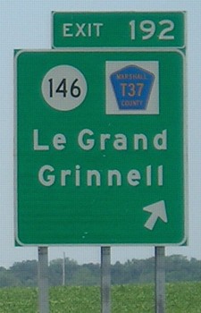
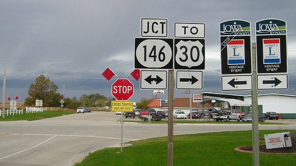
And on this sign, the right arrow is in the right place but the ahead arrow isn't!
Old interchange photos
Facing north on T37 (5/13/02)

Facing north on T37 (9/21/02)
Old NORTH End: Stoplight (was stop sign), US 30 and T37, Le Grand, Marshall County
Facing north on 146 (5/13/02)
From 1928 to 1954, the north end of IA 146 was two miles south, at E49; this view would have been on a connector from US 30 (behind camera and to left, on other side of railroad tracks) to IA 135 (spur into Le Grand).
Facing north on 146 (5/13/02)
Facing north on 146 (7/5/05)
This is the old north end, but you can see the new end in the background.
Facing north on 146 (10/23/19)
Facing east on 30 (5/13/02)
After completion of the bypass, this overpass built in 1953-54 was removed.
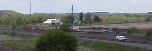
Facing northeast (5/13/02)
This is before massive amounts of dirt were trucked in for bridges over the railroad.
Facing east on 30 (7/16/04)
Facing east on 30 (8/21/04)

Facing west on 30 (5/13/02 and 8/21/04)
Facing west on old 30 (7/5/05)
Facing west on old 30 (10/23/19)
From 2004: Although a majority of Iowa's route of the Lincoln Highway is paved and in good condition - and some portions are still 30 today, although this number shrinks every once in a while - there is no concerted signing effort like that in Illinois. The Iowa Lincoln traveler must seek out the old route, but there is help available (including a map pack sold by the Lincoln Highway Association). In central Iowa, if you can find the road, there may occasionally be an "L" on a telephone pole, but there are no modern signs along the route (exception: Boone County). I would really like to see good, solid, modern signs with arrows to mark the route, marking at least one incarnation with alternate routes where necessary or possible.
The Lincoln Highway has been signed as a Historic Byway in Iowa since 2011. Woo! I've left the above to show how it used to be. (photo: 5/13/02)
"L" meanders north of paving - ¿Que?
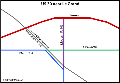
The above photo of the "L" painted on the telephone pole shows the Lincoln Highway going east and west along Le Grand's Main Street. As it turns out, though, the path isn't quite this simple. The Lincoln Highway map pack mentioned above shows the LH following only one route between Le Grand and Montour, using present-day (well, late 1990s) US 30 and T47. However, every state map since 1919 shows the route going south on what today is IA 146 and then east on E49. That's also the route implied in the official 1924 Lincoln Highway guide - the Le Grand control point is the west edge of town - and the route Marshall County paved in 1925-26.
So what happened? The Le Grand Library's website has an explanation: "In LeGrand two grade crossings of the Chicago North Western Railroad on the old route caused the newly designated U.S. 30 to be turned aside and it now left LeGrand with only a connecting spur." That makes the most sense, although the change likely happened in the mid-1910s instead of 1926. IA 135 was designated from the intersection of the green and blue lines eastward in 1926, with an at-grade intersection with the railroad tracks. That way, 30 could parallel the railroad (on a road that no longer exists) before turning south, avoiding crossing the tracks there and in downtown Montour. After new 30 was built with an overpass over the tracks, it and the Lincoln were together again for half a century. (Map: 8/15/09)
Page created 5/26/02; last updated 8/16/09 5/9/20