

- In 1920, they knew it as: The Kingsley-Remsen road, which also went southwest to Moville (2 counties)
- We know it as: IA 140
- Let's get granular: The road between Moville and Kingsley was not diagonalized until 1928. Before that, there is conflicting information. The 1919 state map implies the road runs north on Hancock Avenue from 150th Street (IA 23 at the time). The 1914 county map shows the main road had one more stairstep, going north on Humbolt Avenue, then east on 140th Street, then north on Hancock, east on 120th Street, north on Ida Avenue, IA 140, 100th Street, Quartz Avenue, Quarry Road, and 332nd Street into 1st Street at Kingsley. The 1928 construction documents show the entrance to Moville via 140th Street, Haskell Avenue, IA 140, and 2nd Street, which doesn't jibe with the state maps of the time.
| IA 30 (I) endpoint history | |||
| FROM | TO | SOUTH | NORTH |
| 1/1/20 | 10/16/26 | Moville (via Main St) |
IA 5 at Remsen (IA 3) |
| IA 30 renumbered IA 140 | |||
| 10/16/26 | 1928 | Moville (via Main St) | IA 5 at Remsen (IA 3) |
| 1928 | 5/27/31 | US 20 (present spot, more or less) | |
| 5/27/31 | 11/28/59 | US 75 (IA 141 at K45) | |
| 11/28/59 | 6/1/61 | I-29 (IA 141 at I-29) | |
| 6/1/61 | 5/29/63 | IA 141 (K64 at IA 141) | |
| 5/29/63 | 1964 |
ECL Kingsley (2nd St at IA 140) | |
| 1964 | 5/24/67 | US 20 | |
| 5/24/67 | 7/1/80 | Kingsley (Main St at 1st St) | |
| 7/1/80 | Present |
IA 3 | |
| NOTE: From 5/29/63 to 5/24/67, its signed end may have been at Remsen, but the end of state maintenance was in Kingsley. That portion did not appear on state maps during this period. | |||
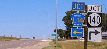
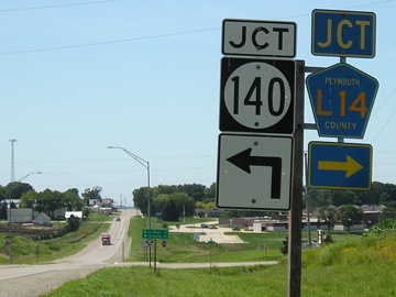
NORTH End (1920-63, 1980-present): Stop sign, IA 3 and L14, near Remsen, Plymouth County
Facing north on 140 (7/23/09)
The building in the northwest corner of this intersection was built in the second half of the decade.
Facing north on 140 (6/14/04)
Facing east on 3 (6/14/04)
On IA 3 at both IA 140 and IA 143, the junction sign with the county road also has an ahead-and-turn arrow for the state highway.
Facing east on 3 (7/23/09)
Facing west on 3 (7/23/09)
Facing west on 3 (7/23/09)
There are two school districts in the Remsen area: Remsen-Union and St. Mary's of Remsen.
Facing south on L14 (7/23/09)
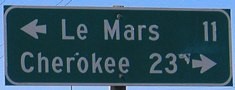
As with the south end of IA 143 on 3, the county road LGS gives a different distance for a town.
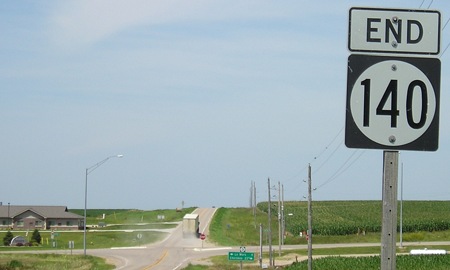
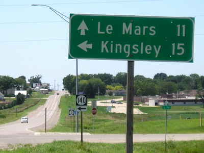
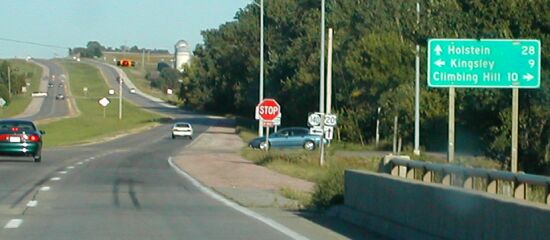
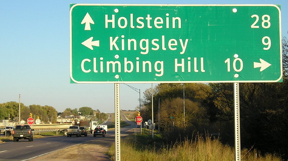
Old NORTH End: 1st Street, Kingsley, Plymouth County
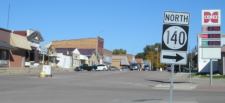
Facing north on 140 (10/20/18)
Kingsley has parallel parking down the middle of Main Street.
The history of the road north of here in the 1960s is complicated. It was still gravel, the victim of neglect in a decades-old tug-of-war between Remsen and Kingsley about whether the road should be where it is today, or a mile west. It ended with Plymouth County agreeing in 1963 to pave the road, but the state would maintain a "temporary route" until the end of 1967. This part is a bit murky, as the segment remained on the 1964 map but was gone a year later. This arrangement likely ended May 24, 1967, when the road in Kingsley was truncated to this intersection. The route before this ran up the block of Main you see here, then east on 2nd Street.
Facing west, but heading south, on 140 (10/20/18)
Might these be among the last square three-digit shields I photograph in Iowa?
1920 SOUTH End: Moville, Woodbury County
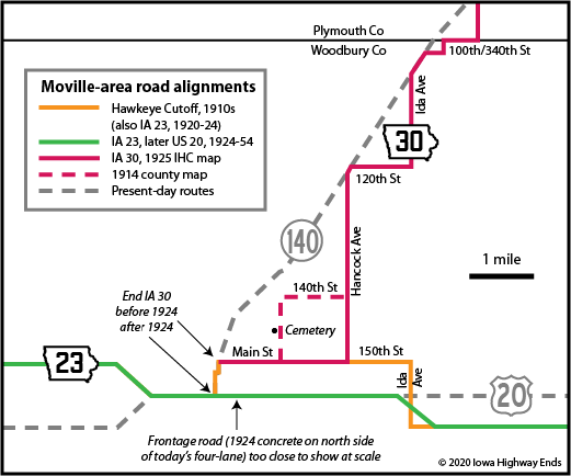
The above map shows a vital change in the Moville area, and my interpretation of 1920 Highway Commission philosophy. In the creation of the primary system, routes that had both ends at different routes (i.e. not "stubs") never ended outside a town — with one exception, IA 29, also in Plymouth County. The IHC got better about this in the winter of 1924-25, when it officially truncated many routes to drop overlaps and, often, end near a community instead of in it. Thus, endpoint-wise, it doesn't matter whether IA 30 used 140th Street and Humbolt Avenue past the cemetery; it still would have been signed to downtown Moville, on the west end of Main Street by the railroad.
Facing east (10/2/20)
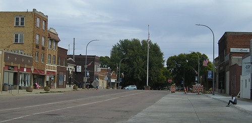
Here's a view of Moville's Main Street, which at the time of my visit was blocked off for Woodbury Central's Homecoming parade. Like in Kingsley, there's a strip of parallel parking down the middle.
The Sioux City-Moville paved road was completed approximately Thanksgiving 1921. The next year, the C.F. Lytle company was contracted to pave a mile of concrete in Moville, its main street. It might seem insignificant, but this mile carries weight in one way: It is likely the first hard-surfaced segment to be bypassed.
Moville
loses their highway fight
Citizens of Moville have lost their fight to have the Sioux
City-Correctionville highway run through the center of town instead of
along the southern border. ...
The original highway passes thru the business portion of Moville, but
upon recommendation of the state highway commission the main highway was
changed to run along the southern edge of town. The change was made in
the interest of shortening the highway.
— Sioux City Journal as
reprinted in Kingsley News-Times,
May 31, 1923
Woodbury County celebrated its extremely forward-looking road program of the time with a dedication in Correctionville on October 21, 1924. At the end of that year, it had 15% of the rural concrete in the state and the most of any one county. The two-year-old mile of concrete in downtown Moville still had a role, though. State maps show, just barely, a line above the relocated IA 23 east of Moville — IA 30 remained on Main Street until the route to Kingsley was diagonalized in 1928.
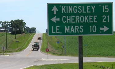
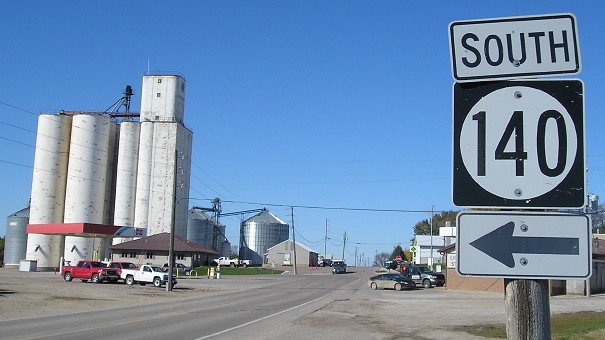
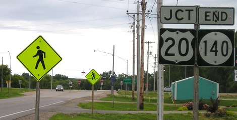
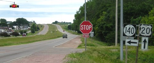
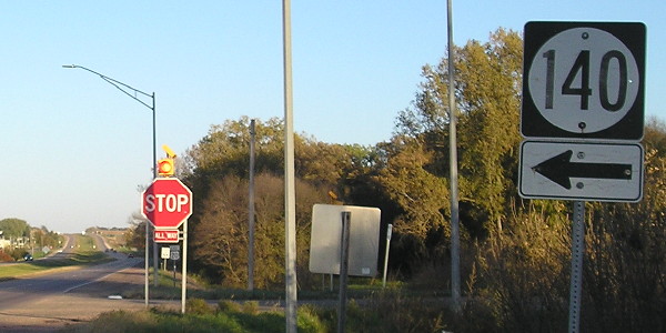
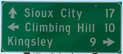
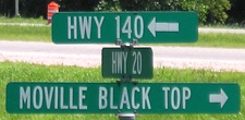
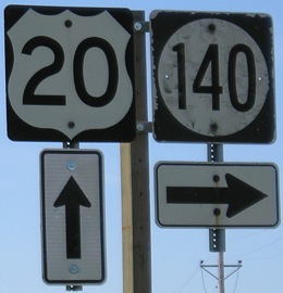
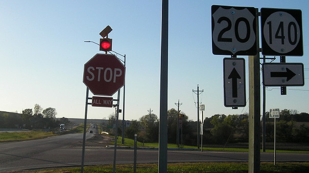
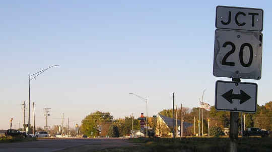
SOUTH End: 4-way stop, US 20 and K64, Moville, Woodbury County
Facing south on 140 (6/12/05)

Facing south on 140 (6/12/05)
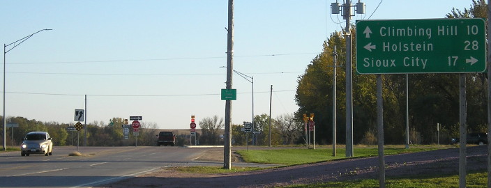
Facing south on 140 (10/19/18)
To the left/east of this picture is not just "old 20" but old old 20: A frontage road on the north side of the frontage road. The 1924 paving that became US 20 passed by right about here. By 1949, the intersection had been reconfigured and the Little Sioux River moved.
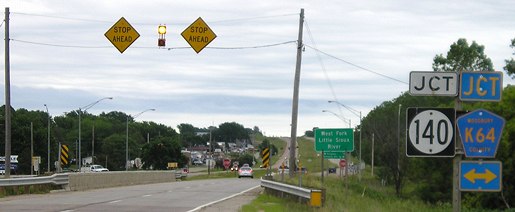
Facing east on 20 (6/12/05)
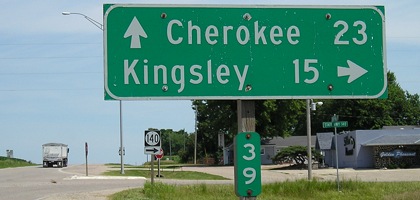
Neil Bratney writes, "The intersection is on the other side of the Little Sioux River. Note that Co. K64 is signed with a double arrow; it diverges from IA 140 north of Moville, and heads toward Oyens, Le Mars, and Orange City. IA 140, on the other hand, follows the Little Sioux toward Kingsley and Remsen." Neil's picture from 2002 included a "20 ^" near the river sign.
Facing east on 20 (10/19/18)
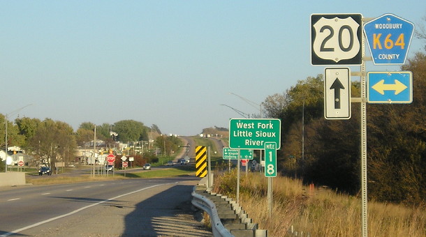
Facing east on 20 (10/19/18)
Facing east on 20 (9/20/02)
Photo by Neil Bratney
This is the only four-way stop for US 20 in the entire state. With completion of the four-lane across Iowa, thru traffic on 20 does not have to stop again until the outskirts of Dubuque. Note that in the most recent pictures, the overhead flashing red is gone, replaced with lights above the stop signs.
Facing east on 20 (10/19/18)
Facing east on 20 (6/12/05)
Facing east on 20 (10/19/18)
Facing west on 20 (7/23/09)
Facing west on 20 (7/23/09)
Facing west on 20 (10/19/18)
Facing north on K64 (10/19/18)
Points of interest
- The longest extent for IA 140 was 1960, when for about 19 months it went from I-29 near Sloan to its present north end at Remsen, 52 miles. Its shortest extent was 1966-80, when it only ran 9 miles from Moville to Kingsley (and also served as the west end of IA 243 to Pierson).
- With two exceptions, the first versions of highways 137 to 146 were replacements for numbers taken for the US highway system in 1926. In this case, 140 replaced IA 30.
- Additional citations for this page: Kingsley News-Times, November 3, 1921; Onawa Democrat, October 9, 1924; Iowa Highway Commission Service Bulletin, April-May 1922
Page created 5/4/04; last updated 3/10/10 10/29/20