
| IA 136 endpoint history | |||
| FROM | TO | WEST/NORTH | EAST/SOUTH |
| 10/16/26 | 12/1/30 |
US 61 (IA 136 at US 61) |
US 55, later US 67 (Main Ave at 3rd St,
Clinton) |
| 12/1/30 |
7/8/31 |
IA 117 (IA 136 at E jct IA 64) |
|
| 7/8/31 | 8/6/35 | Onslow | |
| 8/6/35 | 1/1/38 | US 161 (IA 136/Johnson St at Business 151/1st Ave, Cascade) | |
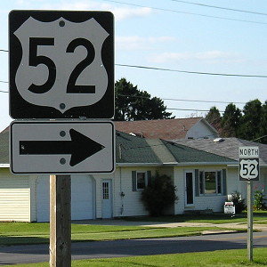
| 1/1/38 | 12/20/63 | US 52 and IA 3, Luxemburg | |
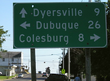
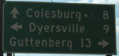
| 12/20/63 | 12/7/66 | US 20 (IA 136/11th St SE at 2nd Ave SE, Dyersville) | |
| 12/7/66 | 10/11/67 | Illinois state line (Lyons-Fulton Bridge, Main Avenue) | |
| 10/11/67 | 1/20/75 | US 52 and IA 3, Luxemburg | |
| 1/20/75 | 2022 | Illinois state line (Morris Bridge) |
|
| 2022 | Present | US 20 and US 52, Dyersville | |
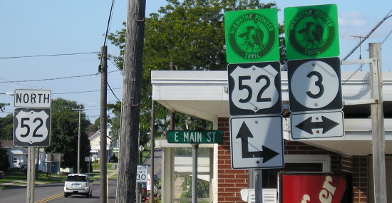
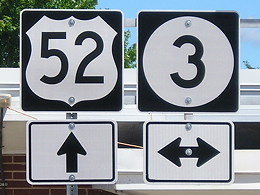
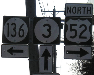
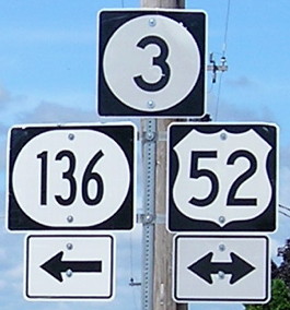
NORTH End: 4-way stop, US 52 and IA 3/Main St., Luxemburg, Dubuque County
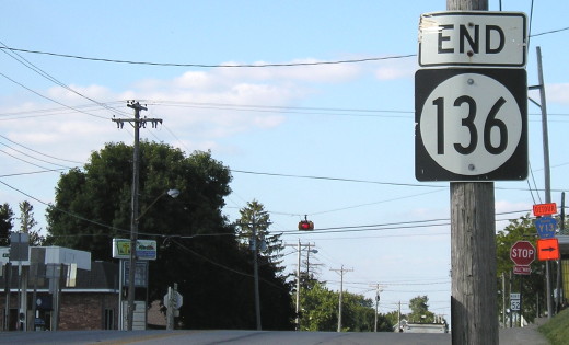
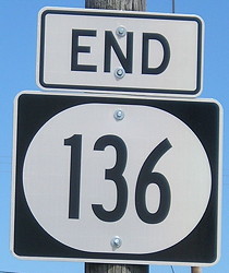
Facing north on 136 (9/1/09 and 7/16/20)
At this intersection, US 52 goes ahead and to the right behind, and IA 3 crosses the street.
LGS before "End" sign (9/1/09)
Iowa 136 is a highway that begs to be split. Although it is signed north-south, half of it is in an east-west direction, turning in Oxford Junction. Between US 61 and Lost Nation, you are traveling southwest while going "north". I would split the road in Wyoming, where 136 shares a mile with IA 64, creating a north-south highway and an east-west highway, and probably assign new numbers to both parts.
Facing north on 136 (9/1/09)
Facing north on 136 (7/16/20)
Facing east on 3 (9/1/09)
Facing east on 3 (9/1/09)
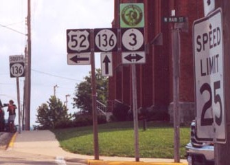
This is not the end of IA 3, only the end of its own road. From here to Dubuque it is duplexed with US 52, probably to finish its status as a cross-state highway. With the opening of the Southwest Arterial and reroute of US 52, IA 3 from this point is essentially a really long spur to Sageville.
Facing east on 3, but (formerly) heading south on 52 - or not (9/1/09)
See the dark diagonal asphalt strip? More on that below.
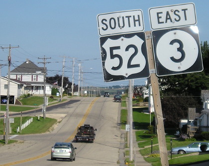
Facing south on 52 (9/1/09)
Facing south on 52 (7/28/02)
Photo by Jason Hancock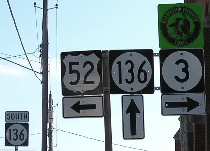
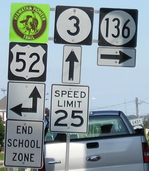
Facing south on 52 (9/1/09)
Whenever this assembly was changed to that it all balances on one pole, the arrow under the IA 3 shield was incorrectly switched to right (west) only.
Facing south on 52 (7/16/20)
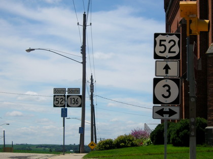
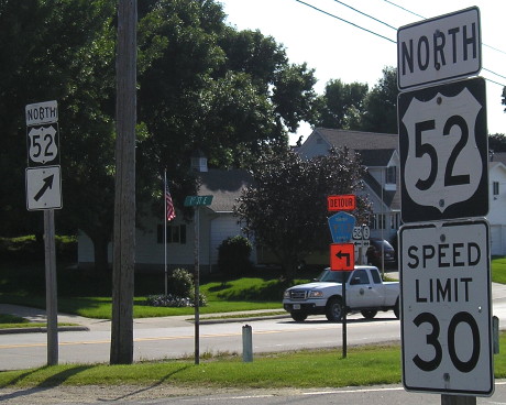
Now the Hiawatha Pioneer Trail is gone, 52 has been rerouted, and there's a flashing signal with the stop sign.
Facing west on 3, but heading north on 52 (9/1/09)
Facing west on 3, but (no longer) heading north on 52 (9/1/09 and 7/16/20)
Facing west (9/1/09)
If you enter Luxemburg from the east, you run (ran) into this setup before the church and 136 intersection because there was a short diagonal for 52. (The 52/3 assembly by the detour sign is for curve travelers in the opposite direction.)
At the other end of the curve is this sign. The official city map shows the diagonal as a red line, implying a state-maintained road. This is just north of the mileage sign on southbound 52. (9/1/09)
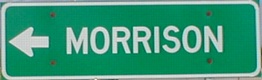
SOUTH End: Illinois state line, Clinton IA/Fulton IL, Clinton County IA/Whiteside County IL
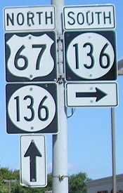
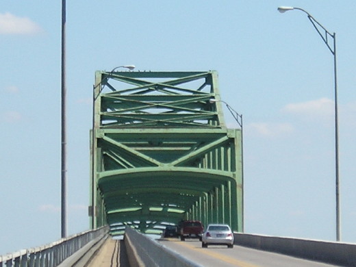
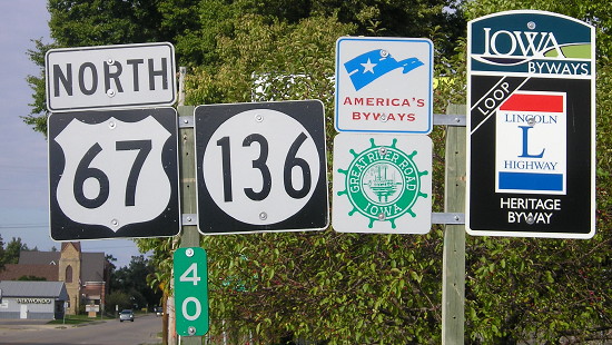
Facing north on 67 / Facing east, but heading south, on 136 (9/1/09)
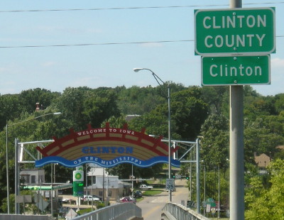
In Clinton, 67 and 136 share 8 blocks, or 0.6 miles. Before the current bridge opened the two only shared 3 blocks. The first sign after the intersection is the last 136 sign in Iowa. Since the photo on the right was taken, a Lincoln Highway Heritage Byway sign has been added to this post and "End Lincoln Highway" is on the "Welcome to Clinton" gantry by the white car.
Facing east, but heading south, on 136 (9/1/09)
Facing east, but heading south, on 136 (9/1/09)
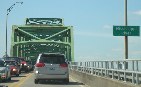
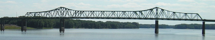
This is the bridge into Illinois, which replaced the Lyons-Fulton bridge in 1974. The Lincoln Highway originally came into Iowa on the Lyons-Fulton, which had four "through" trusses, one deck truss, and two trestle approaches (according to the Lincoln Highway Iowa Map Pack).
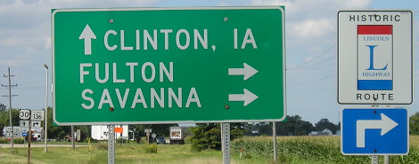
Facing east on IL 136 (Dude!) (9/1/09)
Facing east on IL 136 (but that's an Iowa Clearview sign) (9/1/09)
Facing west, but heading north, on 136 (5/25/02)
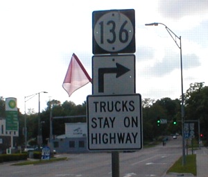
The first 136 sign in Iowa indicatest that it turns. Notice the "buzzsaw" BP at the intersection.
Facing west, but heading north, on 136 (9/1/09)
Facing west, but heading north, on 136 (9/1/09)
Facing south on 67 (9/27/15)
Facing north on 67, after the intersection (9/27/15)
Old SOUTH End (December 7, 1966-January 20, 1975): Mississippi River (Lyons-Fulton Bridge), Clinton County IA/Whiteside County IL
Facing east on Main Avenue (7/6/13)
After US 30 moved to the new bridge closer to Clinton's downtown in 1956, the old route up US 67 and into Illinois via the Lyons-Fulton Bridge was designated US 30 Alternate. At the very end of 1966, the official route description of IA 136 was extended to the county/state line, but the 1967 map didn't show this.
This is where that north-south jog on the bridge would have started. Today, the street stops and the Lincoln Highway loop returns to US 67.
Facing west (9/1/09)
The berm is behind the camera. This is about where drivers would reach ground level.
Facing south (9/1/09)
This is a view of the current bridge from the area of the original bridge's entry into Iowa.
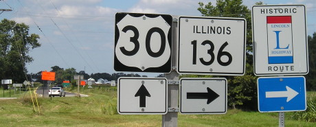
EAST End of IL 136: Stop sign/T intersection, US 30, Whiteside County IL
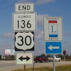
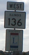
Facing east on 136 (5/25/02)
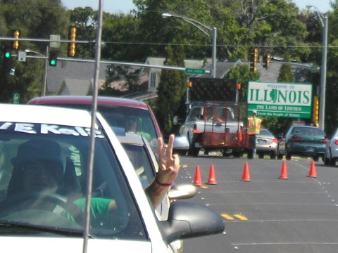
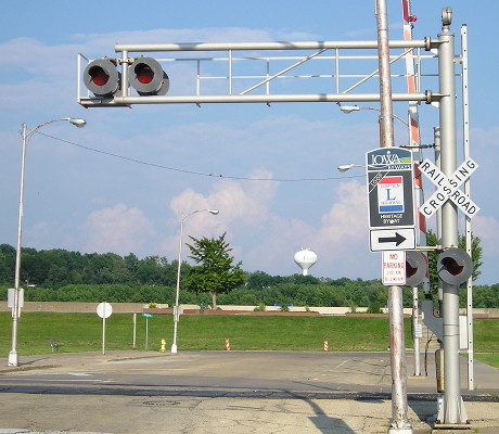
Illinois does an excellent job of signing the Lincoln Highway. I wish Iowa did the same. Now Iowa does too!
I really like the LGS at this intersection.
Facing west on 30 (9/1/09)
Facing west on 30 (9/1/09)
Notice the curve of the road where the white car is, showing how the original Lincoln Highway route came straight through.
Facing east on 30 (5/25/02 and 9/1/09)
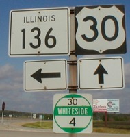
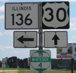
The US 30/IL 136 intersection is 4 miles into Illinois, which is reflected by Illinois' unique county-by-county mile markers. But what's with the "30" route number being replaced with a "78"??
The signage on the very short IL 136 reflects its true direction, and is not to be confused with US 136 in Illinois. It's the opposite situation in Iowa, where the US route is the tiny one and the state route is longer. (5/25/02)
Page created 9/14/02; last updated 12/19/21