 SOUTH
and
SOUTH
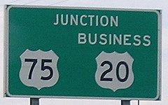
and  BUSINESS
at and
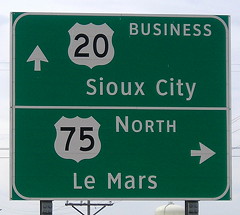
BUSINESS
at and 
Although all signs were removed for IA 12 at this interchange in 2000, the road through Sioux City, including the Grand Avenue viaduct, remains officially part of IA 12 as an unsigned route.
EAST End of Business 20/Secret SOUTH End of IA 12: Interchange, US 20/75, Sioux City, Woodbury County
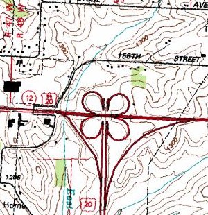
USGS topographic map (ca. 1993)
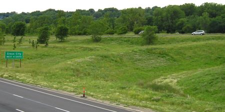
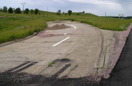
Even back in the late 1970s, when the "520 bypass" was being built around Sioux City, there were plans to extend the four-lane north. The area was accordingly constructed into a full cloverleaf interchange, but with only two outer ramps and two inner loops paved (not four as shown above). The aerial photos below, taken 14 years apart, show the difference between what would have been and what actually is.
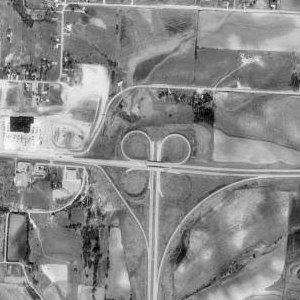
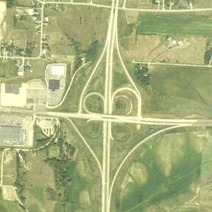
USDA/NRCS/MIT images (1990 / 2004)
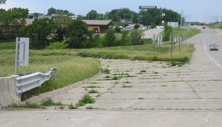
Jason Hancock says that the interchange was cut to six ramps from eight because of cost concerns. To me, this seems like a non-argument. The loop ramps were already graded, and one of the existing ones had to be torn up anyway to make traffic come to a full stop, for a net "savings" of one ramp. In the pictures that follow, the "ghost ramp" stubs will be evident. Clockwise from 9 o'clock:
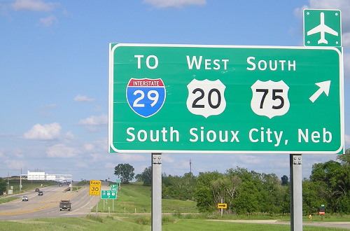
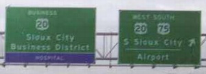
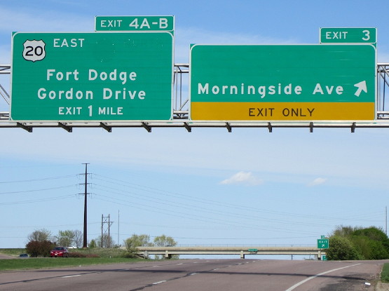
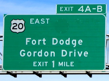
Eastbound Business 20/Southbound IA 12
Facing east on Business 20, but heading south on 12 (6/12/05)
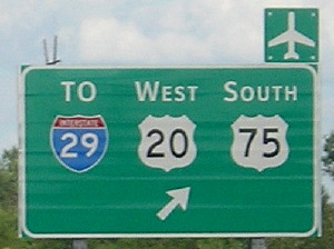
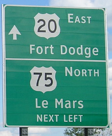
Closeup of above signage (6/12/05)
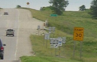
You can see how the wide bridge, ramp stub on this side of it, and sculpted land show a planned cloverleaf. All the signs visible in this blurry photo have been replaced (below).
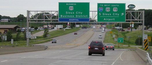
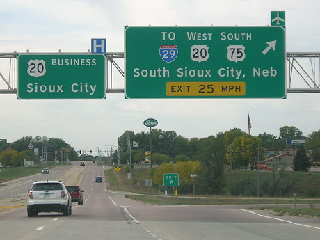
Facing east on Business 20, but heading south on 12 (7/16/14)
I wonder why "To 29" gets precedence. I would've put it at the end.
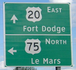
Facing east on Business 20, but heading south on 12 (7/16/14)
This is the second notice for the turn, placed right after the ramp.
Facing east on Business 20 becoming 20 (6/12/05)
That "East 20" in left center would have made a great "End Business 20" and might have been the spot for "End 12".
Facing west (6/12/05)
This is the stub for southbound-to-eastbound traffic. The sign backs are the ones we're facing in the above pictures.
Facing east on Business 20 becoming 20 (6/12/05)
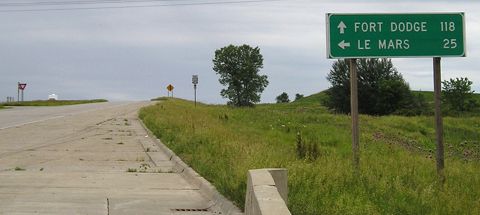
Had this become a full cloverleaf, Le Mars would have been a right turn from this spot, going between the purple thistles and the trees.
Facing east on Business 20 becoming 20 (7/16/14)
Facing east on 20 (6/12/05)
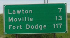
A bit west of the interchange is this, the first mileage sign on 20 in Iowa. After "Sioux City Next 5 Exits" on the Nebraska side before crossing the Missouri River, there are no distance signs on the bypass. Only three destinations - Fort Dodge, Waterloo, and Dubuque - ever occupy the bottom line, with the occasional Cedar Falls on older signs.
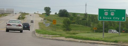
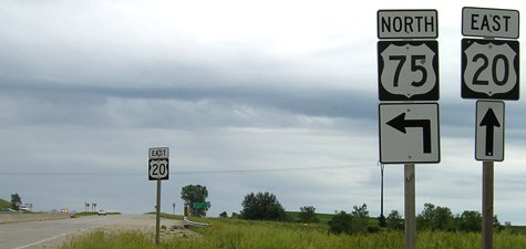
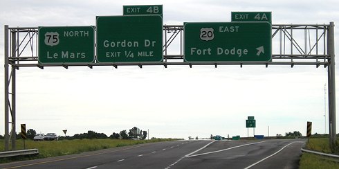
Southbound US 75
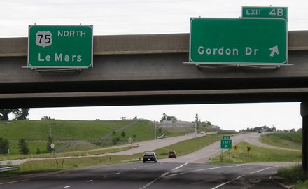
Facing south on 75 (6/12/05)
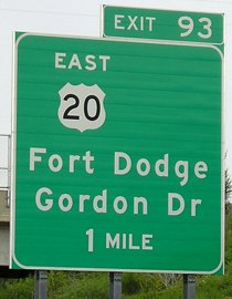
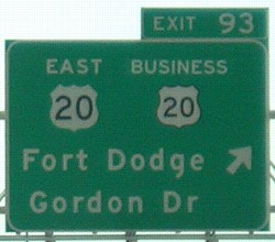
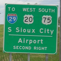
It's curious that these are new (2001) signs yet there is quite obviously space for something else. If not a space for IA 12, why not at least put Business 20 on here? (Update: They did, see below.) And the text order should probably be the other way around, since Gordon Drive is the local road and right turn whereas Fort Dodge is a destination city and a left (although from the same spot). Despite only being four miles from 75's entry into Nebraska, "legacy" mileage is used around 75's part of the bypass based on the distance from Council Bluffs - a mistake, IMHO.
Facing south on 75 (flash on left) (6/12/05 and 9/17/07)
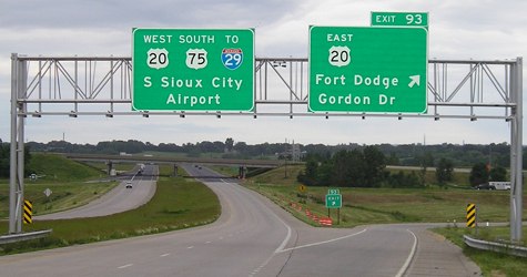
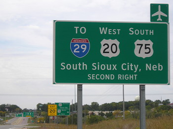
As you can also see on the westbound pictures and at the north end of Business 75, there is a lot of signage for I-29. This one, at least, puts it in its right place at the end of the list. South of this interchange, the whole freeway has been re-asphalted in the past couple of years and there will soon be big multidirectional light poles at this interchange.
Facing south, other side of the bridge (6/12/05)
This is where the offramp for southbound 75 to eastbound 20 would be had the original plan been followed.
Westbound US 20
Facing west on 20 (10/2/20)
Facing west on 20 (6/12/05 and 10/2/20)
The first right is for northbound 75 (below).
Facing west on 20 (10/2/20)
Facing west on 20 (2002)
Photo by Neil Bratney
Facing west on 20 (6/12/05)
The left sign used to have a "North 12" with it. It's possible or even likely that "To 29" was a later addition to the right sign - maybe even the same base as Neil's, but moving the 20 and 75 shields over. In the foreground you can see striping on the bridge from where the northeast loop (eastbound 20 to Business 20) came in.
Facing west on 20 (10/2/20)
Eastbound US 20/Northbound US 75
Facing north on 75, but heading east on 20 (4/8/12)
Photo by Jason Hancock
The BGS on the left clearly has a ghost for IA 12. The BGS on the right has an empty space for IA 982. I've ramped up the contrast on the same photo below:
Closeup of above left sign (4/8/12)
Photo by Jason Hancock
Facing north on 75, but heading east on 20 (6/12/05)
The middle BGS (which was the left one until 75 was rerouted) used to have "12 North" but should now have at least "20 Business". If US 75 used the correct (post-1984 alignment) mile markers, there would be nothing wrong with the tabs. However, since it does NOT, as you can see from the southbound signs, we have US 20 exiting from itself.
Facing south in the northbound lanes (6/12/05)
This is the stub for eastbound Business 20 to northbound 75 (the turn that doesn't exist at the Le Mars LGS).
Facing north on 75 (6/12/05)
This picture is from roughly the same spot as the stub. Prior to completion of the 75 bypass all traffic would have had to exit here - and it would have been a true loop, not the inner ramp of a folded diamond.
Page created 6/29/05; last updated 1/27/08 10/29/20