
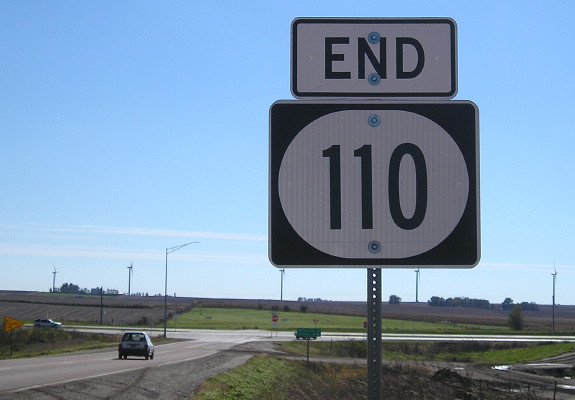
NORTH End: Stop sign, IA 7, near Storm Lake, Buena Vista County
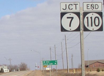
Facing north on 110 (3/20/03 and 10/20/18)
![]()
Facing north on 110 (3/20/03)
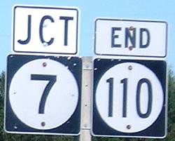
My speculation is that this pole may have held a "To 71 ->" but that's probably wrong, given the location of the 7 with double arrow below.
Facing north on 110 (10/20/18)
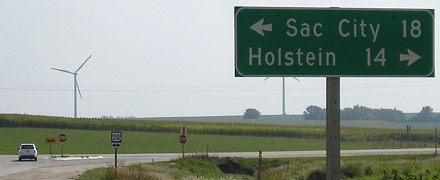
Facing west on 7 (3/20/03)
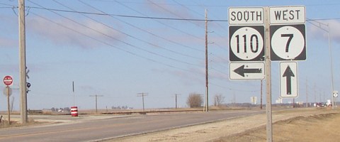
Facing west on 7 (3/20/03)
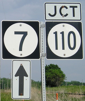
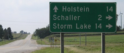
Facing east on 7 (6/5/14)
Facing east on 7 (3/21/03)
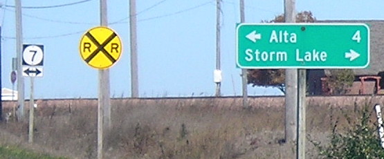
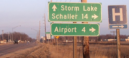
Notice the Storm Lake city limits sign between here and the final signs. While a former alignment of IA 4 connected Denison and Storm Lake, 110 serves mainly as a cutoff for US 71 (and now more specifically Storm Lake) to US 20.
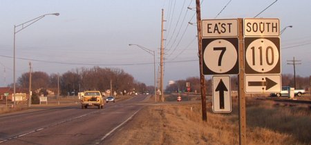
Facing east on 7 (3/21/03)
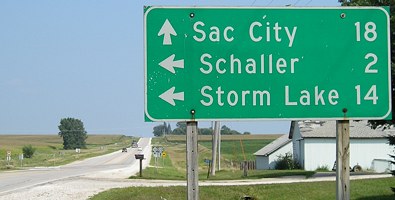
Surrounding area information: 110's turn
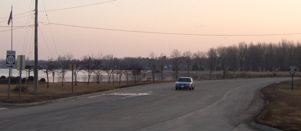
Facing southwest, but heading south, on 110 (3/21/03)
Within sight of the north end is a turn southwest to go around Storm Lake. The road the car is on continues at lower left, and that traffic doesn't stop. The layout of the road substantiates a pre-1967 alignment that show 110 continuing further into Storm Lake than just skirting the west end; see maps below. Shields for 110 are at far left and far right.
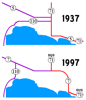
Interestingly, a Storm Lake Pilot-Tribune article from 1965 indicated that 110's signage did not stop when it met US 71, but instead went north the 2½ blocks through downtown to the split of 71 and IA 5 (later 7). (Graphic created 6/22/03)
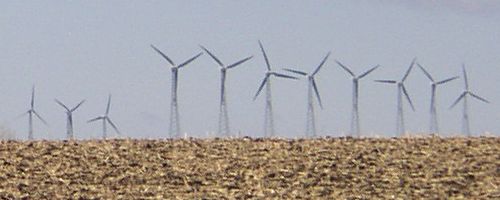
Northwest Iowa is a very windy area. This picture is back near the north end. (3/20/03)
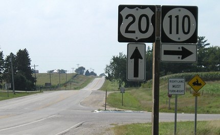
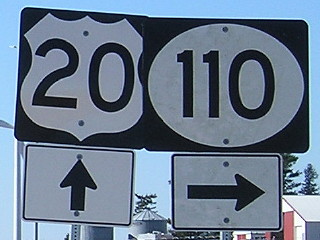
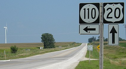
SOUTH End: Stop sign/T intersection, US 20, Sac County
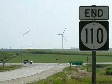
Facing south on 110 (8/31/08)
Facing south on 110 (10/19/18)
Facing south on 110 (8/31/08)
The turbines prominent in the background were not there in 2004.
Facing west on 20 (8/31/08)
Facing west on 20 (8/31/08)
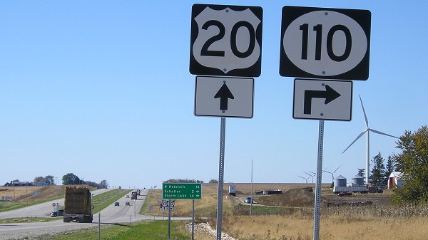
Facing west on 20 (10/19/18)
It looks like four-laning US 20 came at the cost of a lot of trees. Note how the gently rolling 20 has been ironed out.
Facing west on 20 (10/19/18)
Facing west on 20 (10/19/18)
Facing east on 20 (8/31/08)
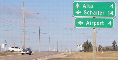
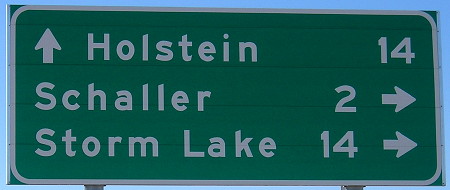
Note the mileage compared with the north end: Here, Storm Lake is 14 miles away, yet Schaller is also 14 miles from the north end at IA 7. The extra 2 miles for Storm Lake go to the downtown.
Facing east on 20 (8/31/08)
IA 110 is the middle of three state highways that have an at-grade end at US 20 (the others are 140 and 32). In this part of the state, 20 is still running along the Survey Correction Line that creates the offset in counties' townships, so it has a lot of T intersections.
Northeast corner of intersection (6/14/04)
Page created 5/3/04; last updated 12/22/08 3/18/19