

(July 1, 1920-December 31, 1992)
- In 1920, they knew it as: The part of the Imperial Highway that IA 9 didn't cover (3 counties)
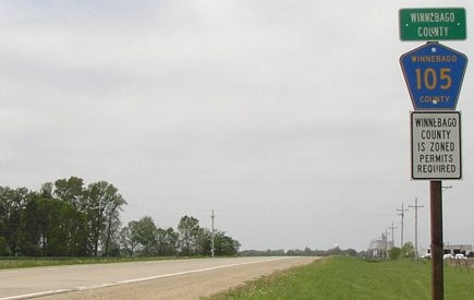
- We know it as: County Road 105
- Let's get granular: Present CR 105 with the exceptions of the following:
- Main Street, Lake Street or Winnebago Street (?), and 3rd Avenue in Lake Mills; the extension of Main and the curves weren't there until 1926, but I'm not sure what the north-south connection was
- Grouse Avenue and 460th Street southwest of I-35
- A little dip on the west side of Northwood to use the 4th Street bridge across the Shell Rock River
- 460th Street and S68 northwest of Carpenter
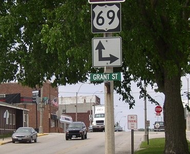
1920 WEST End: IA 15, now US 69/Main St. at R74/Mill St., Lake Mills, Winnebago County
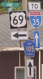
US 69's departure route from Lake Mills northward was changed with paving in 1939. This intersection is two blocks west of the present one, at the center of downtown.
WEST End: 4-way stop, US 69 N/Lake St. and US 69 S/Main St., Lake Mills, Winnebago County
Facing west on 105 (5/19/04)
Save for straightenings and slight realignments customary of routes before 1950 (see top), 105 remained unchanged for its 72½ years between Lake Mills and St. Ansgar. At one time, it was part of the major route in northern Iowa, the Imperial Highway, which ran between Lansing and Sioux Falls. When IA 9 was commissioned in 1920, it took most of the Imperial except for the piece that became 105, presumably so the route could go through the county seats of Forest City and Osage.
Facing east, but heading north, on 69 (5/19/04)
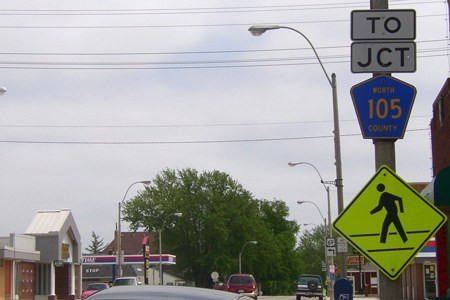
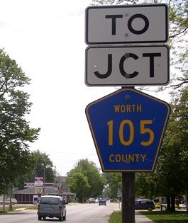
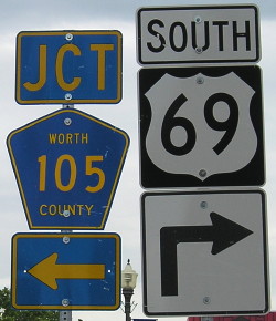
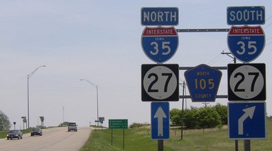
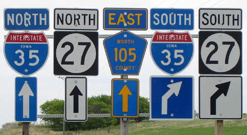
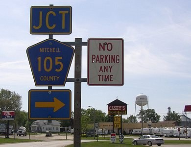
This sign is where the "Jct 105" would have been. The "To" was most likely added to reflect the fact that from here 2 miles east to the county line, the decommissioned route was IA 971 until 2001, and still 971 inside Lake Mills until July 1, 2003. This is probably also why the signs here say Worth County 105 instead of Winnebago County 105.
Facing east, but heading north, on 69 (10/6/06)
Even after all the signs at this intersection were replaced, the county road marker still says Worth County.
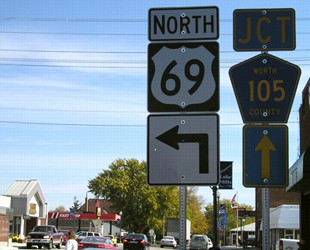
Facing east, but heading north, on 69 (5/19/04)
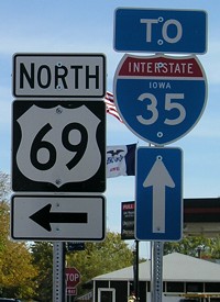
Facing east, but heading north, on 69 (5/19/04 and 10/6/06)
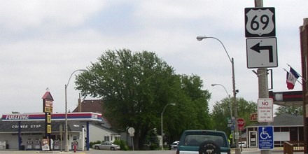
Facing south on 69 (5/19/04)
Facing south on 69 (7//7/11 and 10/6/06)
The net result of the change in signage is less warning for 105.
Facing east on 105 (5/19/04)
Pretty impressive for 34 miles of state highway to go poof in one shot. (Well, OK, only about 29 of those 34 miles were zapped at the end of 1992, but the point's still valid.)
Surrounding area information: Norwegian Immigrant Monument
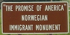
Right across the road from the leaving-town sign above, where 105 turns southwest, is this monument to the area's Norwegian heritage. (7//7/11)
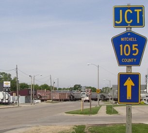
Along the route: East end of IA 971 (1993-2001)
Facing west on 105 (5/19/04)
Lake Mills is in the distance. The pavement switch at lower left marks the county line. Winnebago County and the towns of Northwood and St. Ansgar did not receive jurisdiction over their small parts of IA 105 immediately at decommissioning, which makes me wonder if Worth County was behind the whole thing. (Or if Worth and Mitchell said yes but Winnebago and the two towns said no.) Highway 971 did get marked and signed on the map a few years, but by 2003 only the segment in Lake Mills remained. The sequential series of secret state routes (say that five times fast!) - 971, 972 (Northwood), and 973 (St. Ansgar) - died in the Second Great Decommissioning.
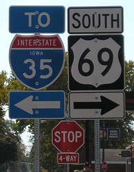
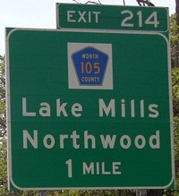
Along the route: I-35 exit 214/Top of Iowa Welcome Center
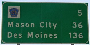
Facing south on 35 in Minnesota / Facing south on 35 in Iowa (5/19/04)
The last sign heading south on I-35 in Minnesota is nice enough to include an actual County Road 105 shield on it - presumably replacing an IA 105 shield. Since Minnesota gives numbers to county roads, and is switching to blue pentagons, you might think you never crossed the line. The 105 exit and County Road A38 are closer to Minneapolis than Des Moines, which may be an ulterior motive for having Mason City on LGSs at those interchanges.
Facing east on 105 (5/19/04 and 9/29/15)
This setup recalls the state highway days, when "East 105 ^" would be in the middle. The rest area entrance is just behind the photo to the left. UPDATE: This assembly is gone as part of the genericization of Iowa interchange signage (right), sometime in the 14 months between my and Jason's picture (below).
Facing east on 105 (5/25/14)
Photo/closeup by Jason Hancock
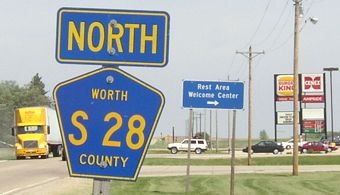
Facing north on S28 (5/19/04)
It helps that a paved county road parallels I-35 so closely right here. Worth County has directional markers on almost all the county roads I saw ... except, ironically, for 105.
The rest-area-at-exit idea works out nicely here with a gas station and a place to eat. Since Northwood is 7 miles east of here and Lake Mills 9 west, the restaurant is the Burger King in the Middle of Nowhere. (It goes nicely with the Golf Course in the Middle of Nowhere, south of Rhodes in Marshall County.) Only the Wendy's in the Middle of Nowhere, in far southeast Iowa at I-29 and IA 2, is farther from an incorporated town.
In 2005, the Iowa Racing and Gaming Commission gave Worth County the go-ahead to build a casino at this site. It opened April 6, 2006 - 11 months afterward.
1920 EAST End: IA 40, now probably 4th St. at School St., St. Ansgar, Mitchell County
A 1911 plat map of St. Ansgar lacks some streets that became IA 40. A 1924 construction document marks a relocation using Center Street and 2nd Street near the railroad. I think that the intersection of 4th and School, again at the center of downtown, is the most likely place 105 first met 40. In 1924 or early 1925 the intersection moved across the railroad tracks to 4th at Center, and when US 218 was paved in 1932, one more block to Park.
(Look at those "St"s right next to each other for two different words. Fun with language!)
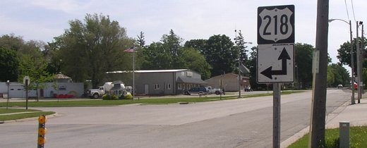
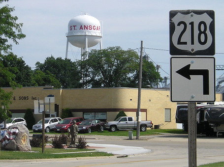
EAST End: T intersection, US 218, St. Ansgar, Mitchell County
Facing east on 105 (5/19/04)
This intersection was reconfigured in the late 1980s. Jason Hancock found a secret IA 946 in 1988-89 that was 370 feet long in St. Ansgar, now the concrete behind the flagpole. Old topographic maps and aerial photos confirm 218 did have a curve here, to Park Street, instead of the southbound traffic coming to a T as it does today.
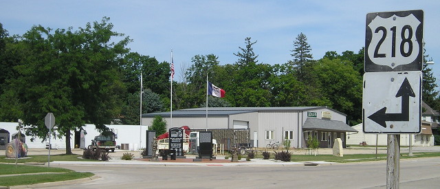
Facing east on 105 (8/4/15)
The veterans memorial got much more elaborate in the intervening decade between pictures. The Mitchell County Freedom Rock is at far left.
Facing west, but heading north, on 218 (5/19/04)
The railroad cars are crossing 105's pavement. The cars were being shuttled back and forth on parallel tracks by the elevator. An elevator with working railroad tracks ... they're a lot rarer now than 35 years ago.
Facing south on 218 (5/19/04)
Facing south on 218 (8/4/15)
Last seen: 1992 (1991 map)
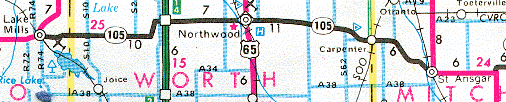
As you can see, 105 wasn't exactly a tiny route. Some maps still had the route for years, including a 2003 construction map from the Minnesota Department of Transportation that not only had 105, but also IA 227 (d. 1991) (marked as IA 277), IA 91 (d. 1980), IA 339 (d. 2001) (marked as IA 331), IA 9 becoming SD 38 (which changed to 42 in the 1990s), and to top it off, adds an "S" to Northwood.
This was the first county road in Iowa to receive a number instead of a letter-number designation (say, A25), probably because everyone referred to it as "Highway 105" anyway.
Page created 6/13/04; last updated 4/15/20