
| IA 100 (III) endpoint history | |||
| FROM | TO | WEST | EAST |
| 8/14/84 | 7/3/85 |
I-380 |
US 151, later Business US 151 (Collins Rd at 1st Avenue) |
| 7/3/85 | 11/25/96 |
Edgewood Road |
|
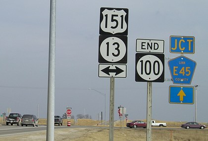
| 11/25/96 | 12/15/16 | US 151/IA 13 | |
| 12/15/16 | 12/12/18 | Covington Road | |
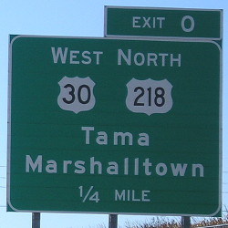
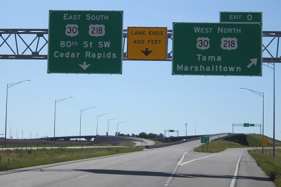
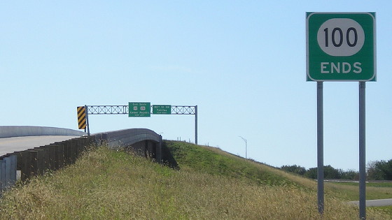
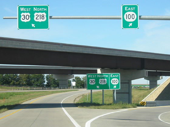
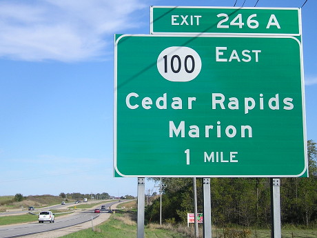
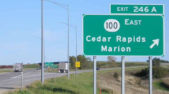
| 12/12/18 | Present | US 30/218 | |
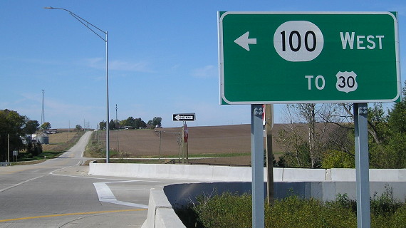
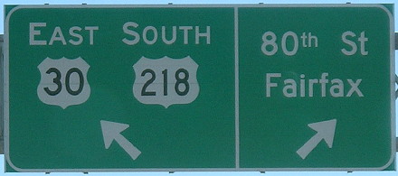
WEST End: Interchange, US 30/218, Cedar Rapids, Linn County
Facing west on E Avenue (all pictures at this end 10/14/19)
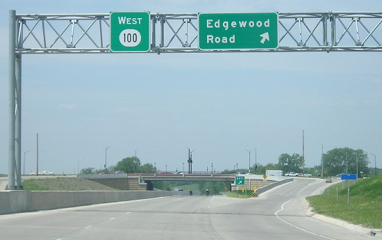
In 2014, it was finally time to add a line to this page. The long-awaited western extension of IA 100 was officially under construction and in the programmed plan to be completed around the end of the decade, and it was. From Edgewood Road, IA 100 goes west, crosses the Cedar River, heads southwest, then heads nearly due south along 80th Street to west end of the Cedar Rapids bypass, where the 16th Street ramp is reused but required rebuilding. Here are links to an overview PDF and individual files of segments.
Facing south, but heading west, on 100
I love a correctly-placed Exit Zero.
Facing south, but heading west, on 100
Facing south, but heading southeast, on 100
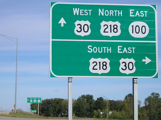
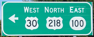
If you don't take the exit to westbound 30, the two lanes cross 30/218 and then fork to 80th Street (which also is how you get to 16th Avenue) and eastbound 30/218. The 80th Street ramp then merges with an offramp from 30.
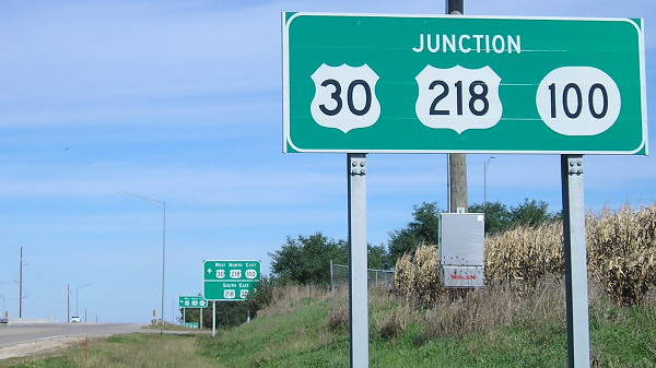
Facing north on 80th Street
Facing north on 80th Street
The "East" is a greenout panel. Was there nothing above the 100 marker originally, or a "To" or a "North"? All seem plausible.
Facing north on 80th Street

Facing south on 80th Street
Because the 100 bypass broke 16th Avenue, the marked Lincoln Highway must turn south onto 80th and get onto 30/218 that way.
Facing east on 80th Street onramp
The foreground bridge is the ramp from eastbound 30 to the beginning of 100. The background bridge is the one from 100.
Facing east on 30
Facing east on 30
The exit ramp is the same one previously used to get to 16th Avenue. After a complete pavement and bridge deck replacement, it now
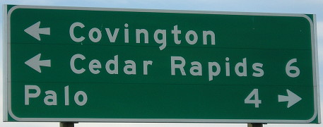
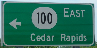
Old WEST End (December 15, 2016-December 12, 2018): Partial interchange, Covington Road, Cedar Rapids, Linn County
Facing southwest, but heading west, on 100 (5/16/17)
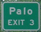
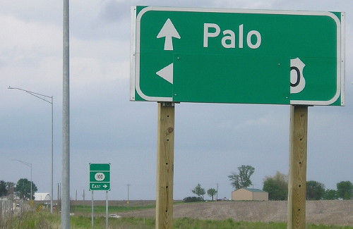
The BGS for Palo has to be the smallest in the state.
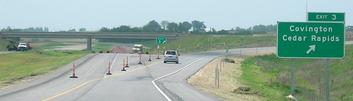
Facing southwest, but heading west, on 100 (5/16/17)
Facing west on offramp (5/16/17)
Facing north on Covington Road (former IA 94) (5/16/17)
All the signs here were ready for the highway's final extension to US 30. All have the oblong 100 shield.
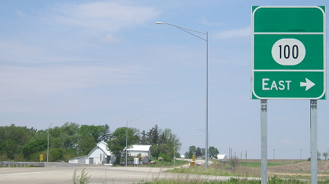
Facing north on Covington Road (former IA 94) (5/16/17)
Facing south on Covington Road (5/16/17)
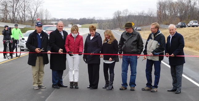
The IA 100 extension to Covington Road (old IA 94) opened to traffic December 15, 2016 - ahead of schedule. Above, local dignitaries cut the ribbon for the extension at Edgewood Road 12 days earlier (12/3/16).
In February 1961, a Cedar Rapids Gazette editorial writer envisioned an "outer-belt highway" remarkably similar to the IA 100 idea that would not come to fruition for more than half a century. The main difference is that he envisioned Edgewood Road being the north-south segment. At the time, Edgewood was closer to but already inside developed areas, and there was no bridge across the Cedar River.
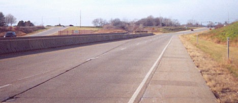
Old WEST End (July 3, 1985-December 15, 2016): Partial interchange, Edgewood Road, Cedar Rapids, Linn County
Facing west on 100 (12/2/01)
Photo by Jason Hancock
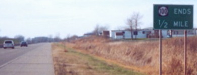
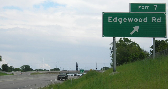
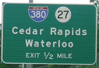
Until 2015, 100 ended at an unfinished half-diamond interchange with Edgewood Road. When the extension was built, the interchange was turned into a SPUI. This sign notes the end of the freeway in half a mile.
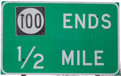
Closeup of above signage (12/3/16)
Facing west on 100 (12/2/01)
Photo by Jason Hancock
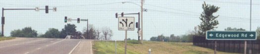
All traffic for 100 was directed onto what would eventually be the off/on ramps for Edgewood Road. Plans to extend the route repeatedly ran into financial and environmental roadblocks. The western extension was projected to be finished in 1990 2005 2016 2020 or Real Soon Now (that's a technical term). Thanks to some accelerated funding, it was finished in late 2018.
Facing west on 100 (5/16/17)
This is roughly in the same place as Jason's photo above, now with a bridge for Edgewood and completed freeway. Notably, there is no exit number on the westbound signs.
Facing east on 100 (5/23/17)
Facing west on 100 offramp (5/18/03) (pre-SPUI)
Photo by Jason Hancock
Facing north on Edgewood Road (5/18/03)
Photo by Jason Hancock
Notice the 100 shield at the ramp. No changes to the area were made until grading began for the western extension in 2013 and Edgewood traffic endured construction in 2014.
Old WEST End (August 14, 1984-July 3, 1985): I-380/IA 27 exit 24/24A, Cedar Rapids, Linn County

Facing west on 100 (5/16/17)
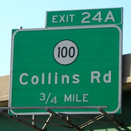
This is an original sign for the interchange. The distance was changed from 1/2 mile to 1/4 mile sometime after summer 2012 despite no actual change in the road. Immediately to the right of this sign at the Council Street intersection was the Junge car dealership; the building was torn down in summer 2017 and is a McGrath overflow lot now.
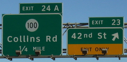
Facing west on 100 (5/16/17)
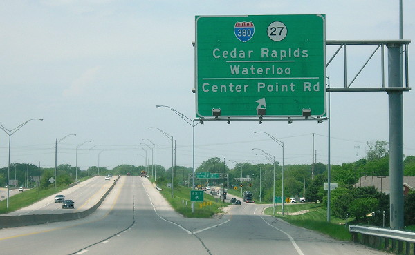
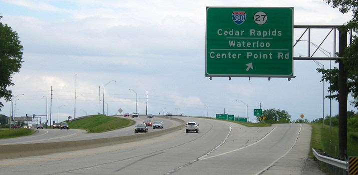
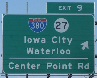
East of I-380, at about the point that old IA 150 took a slight turn southwest before going north, modern 100 has an "exit ramp" that drivers must use to get to I-380. Between here and there is a stoplight at Center Point Road (old IA 150 north). This led to 100's west end for about a year, from commissioning in August 1984 to extension in 1985.
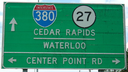
Facing west at Center Point Road (5/16/17)
In the right light the shadow of the formerly centered 380 shield was visible.
Facing west on 100 (5/16/17)
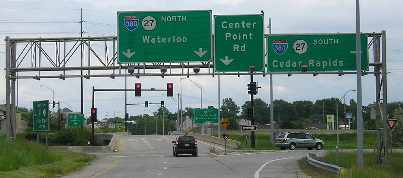
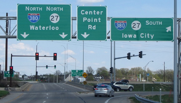
The IA 100 interchange is mixed in with other nearby exits that form a sort of Texas-style frontage road for a distance along I-380 in addition to the volleyball interchange. Compared to the (former) pure volleyball interchange of US 77 at I-29 in Sioux City, this position facing west is equivalent to the first signs you see on the northbound 29 offramp.
Facing west on 100 (10/2/20)
Facing east on 100 (5/23/17)
Facing east on 100 (5/23/17)
Facing east on 100 (5/6/18)
Photo by Jason Hancock
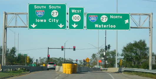
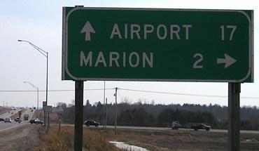
Sign replacement in 2017-18 dropped Cedar Rapids for Iowa City as the southbound control city. It makes sense because we are in Cedar Rapids, although I wonder if "Airport" may actually have been a more useful destination at this location.
Facing east on 100 (5/23/17)
Facing east on 100 (5/6/18)
Photo by Jason Hancock
Facing east on 100 (5/6/18)
Photo by Jason Hancock
You can see this sign and its predecessor in the background of the above photos.
Facing south on 380 (10/21/05)
Photo by Jason Hancock
Facing south on 380, Clearview version (7/26/14)
Photo by Jason Hancock
Facing south on 380 offramp (7/26/14)
Photo by Jason Hancock
Facing north on 380 (7/15/06)
Facing north on 380 (9/4/10)
Photo by Jason Hancock
Facing north on 380 (10/21/05)
Photo by Jason Hancock
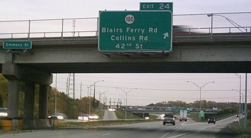
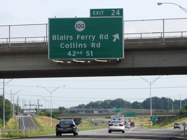
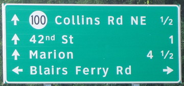
Unlike southbound 380, the exit ramps for 100 and Blairs Ferry Road are split up.
Facing north on 380 (10/25/14)
Photo by Jason Hancock
Facing north on 380 at the volleyball (3/12/07)
The bridge is for 100 "thru traffic" that doesn't have to stop at the stoplights with the I-380 ramps.
Facing north on 380 at the volleyball (10/25/14)
Photo by Jason Hancock
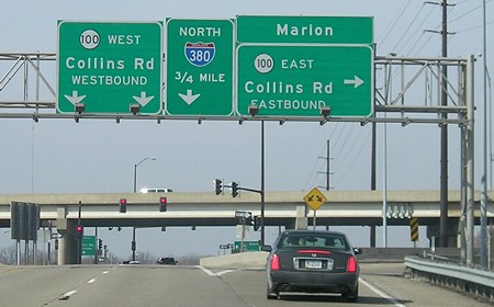
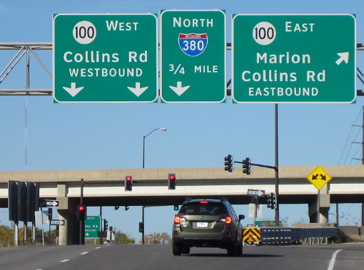
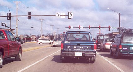
Old EAST End (August 14, 1984-November 25, 1996): Stoplight, Business US 151/1st Ave., Cedar Rapids, Linn County
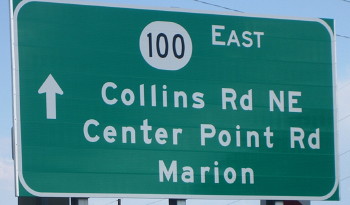
Facing east on 100 (7/16/06)
This was the eastern end of 100 between 1984 (when it was commissioned) and 1996. Before that, it was the south end of 150 before it was rerouted to Vinton. Highway 100 was commissioned August 14, 1984, the same day IA 101 was decommissioned and IA 150 rerouted.
Facing west on 100 (7/16/06)
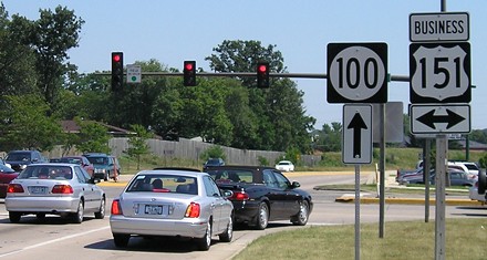
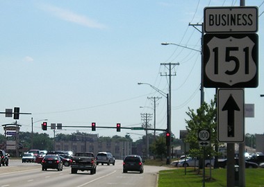
Facing north on Business 151
Photo by Jason Hancock
Before 1996, 100 started at the left of this photo. Jason Hancock says that this is the end of unsigned Iowa 922, which is the DOT's secret number for Business 151 through Cedar Rapids. (The segment through Marion is maintained by the city; the city limits change a few hundred feet north of here.)
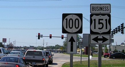
Facing northeast, but heading north, on Business 151 (7/16/06)
Facing southwest, but heading south, on Business 151 (7/16/06)
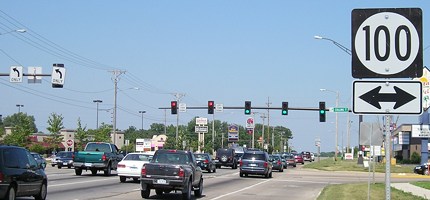
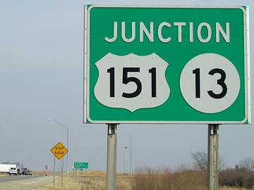
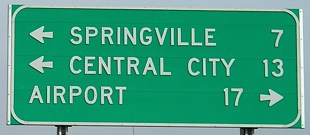
EAST End: Stoplight (was 4-way stop), US 151/IA 13 and E45, Marion, Linn County
Facing east on 100 (3/12/07)
Facing east on 100 (3/12/07)
In 2003, E45 was not marked here.
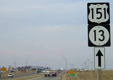
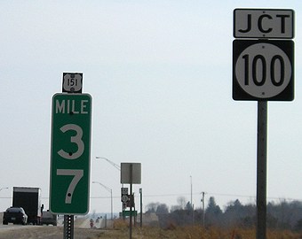
Facing north on 151/13 (3/12/07)
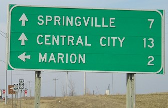
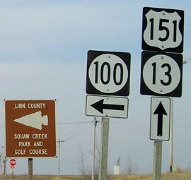
Facing north on 151/13 (3/12/07)
Facing south on 151/13 (3/12/07)
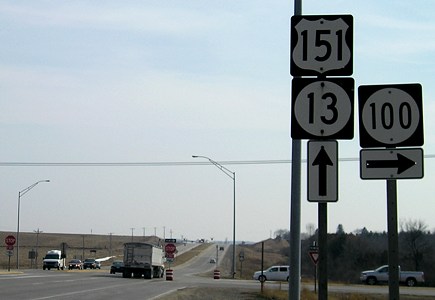
Facing south on 151/13 (3/12/07)
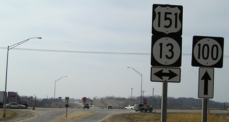
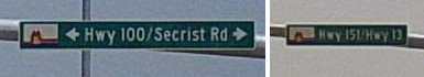
Facing west on Secrist Road (secret Linn Co. E45) (3/12/07)
This intersection is (as of spring 2007) surrounded by farmland, but there is development one mile north at the north end of Business 151 and creeping southward.
Weeks after the above pictures were taken, a stoplight finally appeared at this intersection.
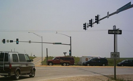
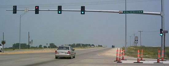
Facing east on 100 (6/17/07)
Photo by Jason Hancock
Signs on stoplight arms (6/17/07)
Photos by Jason Hancock
Facing north on 151 (6/17/07)
Photo by Jason Hancock
Notice that this assembly is prepared for a double-left-turn lane, which is going to be a tight squeeze.
Page created 2/24/02; last updated 12/31/21