This "exit listing" has signs that might have appeared on an Ottumwa-Waterloo freeway. The segment between Waterloo and IA 8 was originally laid out in 1957, and later dubbed IA 402. Its proposed north end was a junction with a new US 20 - the current freeway on Waterloo's south side. A Des Moines Register map indicated possible continuations south to US 6 (when I-80 was still proposed) and US 63 north of Ottumwa (its pre-1997 route). Of the project, only the segment north of IA 8 ever moved beyond the talk stage, and only two lanes were paved, although land was bought for four. Eventually the freeway project was dropped in favor of I-380, and 402 became the northernmost part of 21 on Jan. 1, 1969.
Exits between US 20 and IA 8 were taken from a map in the Traer Star-Clipper April 5, 1957. The rest of them are based on the Register map from Sept. 26, 1956, scanned by Jason Hancock. The maps can be viewed on the IA 402 page. Signs were created using Kurumi's SignMaker Java program (thanks Kurumi!). I tried to make the signs follow the DOT's current exit sign rules, and additional exits say "Next Right" because at the time, not even interstates had mile-based exit numbers. County roads, besides being in the trunk system in the 1950s, are even today only sporadically placed on BGSs.
| Mile (appr.) | Possible signage (SB: start here; NB: go to bottom and scroll up) | Notes |
| 89.75 |
NORTHBOUND: SOUTHBOUND: |
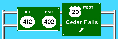
This would be about where IA 21 meets US 20 today. The four-lane would stop at San Marnan Drive, which was IA 412 until 1983. |
| 86 | 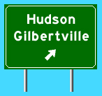 |
County Road D35 |
| 82 | 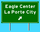 |
County Road D46; D52 had no interchange planned. Eagle Center is less than 1 mile away; see IA 145. |
| 79 | BLACK HAWK / TAMA COUNTY LINE | |
| 76.5 | 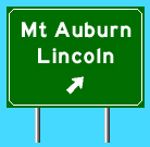 |
County Road D65; Lincoln is first incorporated place west |
| 71 |   |
Planned end of IA 402 in 1957 layout; extensions, if any, would come later |
| 64 | 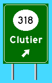 |
Freeway would bisect spur, which was decommissioned in 1980 |
| 56 | 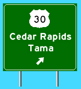  |
|
| 52.5 | 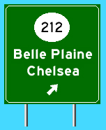 |
May or may not be an interchange, given its proximity to 30 and the Otter Creek Marsh area. For that matter, the marsh may have held up the freeway at 30. |
| 45 | TAMA / POWESHIEK COUNTY LINE | |
| 35.5 OR 37 | 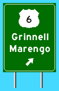 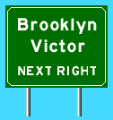 |
Either at current 6 or old 6, now F29, depending on when 402 was built. |
| NB: 32.5 SB: 34.5 (Exit: 33.5) |
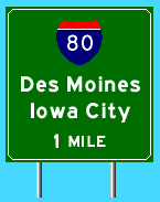 |
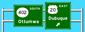
By the time 402 did get down here, there would be an I-80, and a cloverleaf interchange. I-80, or "Relocated U.S. 6", was a proposed second south end for 402. |
| 26.5 | 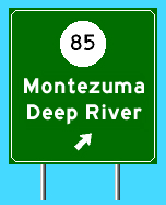 |
This would probably be right near the west city limits of Deep River. |
| 21 | POWESHIEK / KEOKUK COUNTY LINE | |
| 14 OR 17 | 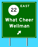 |
Either today's 22 would be extended a bit west to end at a trumpet, or 22 would go south with 21 and west on present G29. Wellman is the first 1000-plus town on 22. |
| 9 | 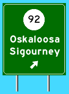  |
|
| 0 |
NORTHBOUND: SOUTHBOUND: |
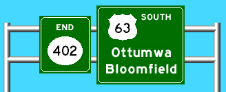
This would be on old 63 as it turns south to follow the Mahaska/Keokuk line near Fremont. Southbound would be a direct merge into 63, while northbound traffic for 63 would exit. See the east end of IA 163. |